25 Stunning Places in Washington State: A Regional Travel Guide & Scenic Routes
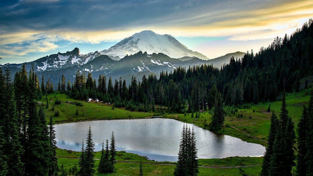
Washington State is a land of staggering geographic contrasts. Within a single day's drive, you can stand beneath 1,000-year-old moss-draped spruce trees in a temperate rainforest, ascend to glaciated volcanic summits towering over 14,000 feet, cruise past killer whale pods in emerald island straits, and gaze across sun-drenched canyon cataracts carved by Ice Age floods.
Because Washington spans five distinct climate zones separated by the Cascade Mountain barrier, attempting to rush through all 25 destinations in a single marathon holiday is both physically impossible and logistically frustrating. Stehekin has zero outside road connections; high-altitude passes like the North Cascades Highway (SR-20) close under winter snow; and Washington State Ferries operate on distinct vehicle staging buffers.
To help you travel intelligently, this comprehensive guide organizes 25 of the most stunning, dreamlike places in Washington State into 5 balanced geographic regions, complete with logistical access advice, elevation facts, seasonal timing, critical mistakes to avoid, and two curated multi-day road trip sub-loops.
In This Washington State Guide (25 Premier Places by Region)
Click any destination below to jump directly to its complete logistics and travel guide:
- Seattle Waterfront & Elliott Bay
- Pike Place Market & Post Alley
- Space Needle & Chihuly Garden and Glass
- Discovery Park & West Point Lighthouse
- Bainbridge Island via Washington State Ferry
- Ruby Beach & Sea Stacks
- Hoh Rain Forest & Hall of Mosses
- Hurricane Ridge Overlook
- Lake Crescent & Marymere Falls
- Cape Flattery & Makah Cultural Trail
- Mount Rainier - Paradise & Skyline Trail
- Mount Rainier - Sunrise & Mount Fremont Lookout
- Reflection Lakes & Pinnacle Peak
- Grove of the Patriarchs & Ohanapecosh
- Mount St. Helens - Johnston Ridge & Coldwater Lake
- Diablo Lake Vista Point (SR-20)
- Washington Pass Overlook & Liberty Bell
- Stehekin Valley & Lake Chelan (No Road Access)
- Friday Harbor & San Juan Island (Lime Kiln Whale Watch)
- Orcas Island & Mount Constitution (Moran State Park)
- Palouse Falls State Park (Zero Commercial Forcing)
- Columbia River Gorge - Beacon Rock & Cape Horn
- Leavenworth Bavarian Village & Icicle Gorge
- Lake Wenatchee State Park
- Dry Falls & Grand Coulee Heritage Area
| Natural Wonder | Geographic Region | Elevation | Pass / Permit Required | Ideal Timing |
|---|---|---|---|---|
| 1. Seattle Waterfront & Elliott Bay | Puget Sound & Seattle | Sea Level (0 ft) | None (Free Public Pier Access) | Late Afternoon to Sunset |
| 2. Pike Place Market & Post Alley | Puget Sound & Seattle | 130 ft (40 m) | None (Free Public Market) | Morning (8:30 AM – 10:30 AM) |
| 3. Space Needle & Chihuly Garden and Glass | Puget Sound & Seattle | 605 ft (184 m) Observation | Timed-Entry Admission Ticket | Mid-Morning or Blue Hour |
| 4. Discovery Park & West Point Lighthouse | Puget Sound & Seattle | Sea Level to 300 ft | None (Free City Park) | Sunset or Low Tide |
| 5. Bainbridge Island via Washington State Ferry | Puget Sound & Seattle | Sea Level to 400 ft | WSDOT Ferry Ticket (Pier 52) | Full Day or Half Day Excursion |
| 6. Ruby Beach & Sea Stacks | Olympic Peninsula & Pacific Coast | Sea Level | Olympic National Park Pass | Low Tide & Sunset |
| 7. Hoh Rain Forest & Hall of Mosses | Olympic Peninsula & Pacific Coast | 600 ft (180 m) | Olympic National Park Pass | Early Morning (Before 8:30 AM) |
| 8. Hurricane Ridge Overlook | Olympic Peninsula & Pacific Coast | 5,242 ft (1,598 m) | Olympic National Park Pass | Morning or Late Afternoon |
| 9. Lake Crescent & Marymere Falls | Olympic Peninsula & Pacific Coast | 580 ft (177 m) | Olympic National Park Pass | Morning (Calm Water) |
| 10. Cape Flattery & Makah Cultural Trail | Olympic Peninsula & Pacific Coast | Sea Level to 150 ft | Makah Recreation Permit (Neah Bay) | Mid-Day / Low Tide |
| 11. Mount Rainier - Paradise & Skyline Trail | Mount Rainier & South Cascades | 5,400 ft to 7,000 ft | Mount Rainier National Park Pass & Summer Timed-Entry | Morning (Before 9:00 AM) |
| 12. Mount Rainier - Sunrise & Mount Fremont Lookout | Mount Rainier & South Cascades | 6,400 ft to 7,181 ft | Mount Rainier National Park Pass & Summer Timed-Entry | Sunrise or Early Morning |
| 13. Reflection Lakes & Pinnacle Peak | Mount Rainier & South Cascades | 4,860 ft (1,481 m) | Mount Rainier National Park Pass | Sunrise (Mirror Reflection) |
| 14. Grove of the Patriarchs & Ohanapecosh | Mount Rainier & South Cascades | 2,200 ft (670 m) | Mount Rainier National Park Pass | Afternoon / Gentle Shade |
| 15. Mount St. Helens - Johnston Ridge & Coldwater Lake | Mount Rainier & South Cascades | 2,500 ft to 4,314 ft | USFS Monument Recreation Pass | Mid-Morning to Afternoon |
| 16. Diablo Lake Vista Point (SR-20) | North Cascades & San Juan Islands | 1,201 ft (366 m) | None (Free Highway Overlook / North Cascades NP) | Mid-Day Sun (Max Water Color) |
| 17. Washington Pass Overlook & Liberty Bell | North Cascades & San Juan Islands | 5,477 ft (1,669 m) | Northwest Forest Pass | Late Afternoon Golden Hour |
| 18. Stehekin Valley & Lake Chelan (No Road Access) | North Cascades & San Juan Islands | 1,100 ft (335 m) | North Cascades NP Pass / Ferry Ticket | Full Day or Multi-Day Wilderness Stay |
| 19. Friday Harbor & San Juan Island (Lime Kiln Whale Watch) | North Cascades & San Juan Islands | Sea Level to 1,000 ft | WSDOT Ferry Ticket (Anacortes) | Summer (May – September) |
| 20. Orcas Island & Mount Constitution (Moran State Park) | North Cascades & San Juan Islands | 2,409 ft (734 m) | Discover Pass (Moran State Park) & WSDOT Ferry | Late Afternoon Sunset |
| 21. Palouse Falls State Park (Zero Commercial Forcing) | Central & Eastern Washington | 720 ft (220 m) | Washington Discover Pass | Early Morning or Golden Hour |
| 22. Columbia River Gorge - Beacon Rock & Cape Horn | Central & Eastern Washington | Sea Level to 848 ft | Washington Discover Pass | Morning or Sunset |
| 23. Leavenworth Bavarian Village & Icicle Gorge | Central & Eastern Washington | 1,171 ft (357 m) | None for Village / Northwest Forest Pass for Trails | Fall Foliage or Winter Snow |
| 24. Lake Wenatchee State Park | Central & Eastern Washington | 1,875 ft (572 m) | Washington Discover Pass | Summer Afternoon or Winter Snowshoeing |
| 25. Dry Falls & Grand Coulee Heritage Area | Central & Eastern Washington | 1,200 ft to 1,500 ft | Washington Discover Pass | Sunset or Early Morning |
Geographic Zone: Puget Sound & Seattle
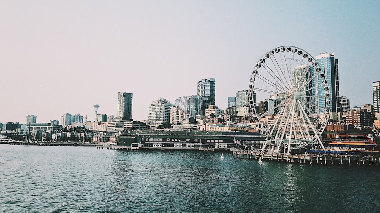
1. Seattle Waterfront & Elliott Bay
A revitalized urban maritime promenade stretching along Elliott Bay, connecting historic timber piers, the Seattle Great Wheel, and the new pedestrian connection from Pike Place Market down to the Salish Sea.
Why It's Breathtaking: Sitting on the eastern shore of Puget Sound, the waterfront offers uninterrupted panoramic vistas across deep maritime waterways to the jagged, snow-draped Olympic Mountain wall across the bay.
How to Reach & Explore:
- Stroll the wide promenade from Pier 55 northward through Waterfront Park, soaking in views of Washington State Ferries gliding across Elliott Bay.
- Board a 1-hour narrated harbor cruise from Pier 55 to gain a maritime perspective on the Seattle working port, shipping terminals, and towering downtown skyline.
- Walk the newly opened Overlook Walk pedestrian bridge connecting the waterfront directly into the upper arcade of Pike Place Market.
Seattle 1-Hour Harbor Cruise on Elliott Bay
Elliott Bay and city skyline narrated orientation
2. Pike Place Market & Post Alley
Operating continuously since 1907, Pike Place Market is the beating heart of Seattle—a bustling multi-level sensory labyrinth of flying wild salmon, artisanal cheeses, fragrant bouquets of Skagit Valley flowers, and labyrinthine cobblestone alleys.
Why It's Breathtaking: Perched above Elliott Bay, the market preserves traditional Pacific Northwest culinary commerce, connecting urban travelers directly with regional fishermen, orchardists, and craftspeople.
How to Reach & Explore:
- Visit the iconic Pike Place Fish Market stall just beneath the clock sign early before 10:00 AM crowds arrive to watch the historic fish toss.
- Duck down into lower-level arcades to explore antique shops, botanical spice purveyors, and quirky craft booths tucked into historic wooden ramps.
- Walk down Post Alley to visit the famous Gum Wall and pick up fresh warm clam chowder in a sourdough bread bowl from Pike Place Chowder.
3. Space Needle & Chihuly Garden and Glass
The architectural icon of the Pacific Northwest, built for the 1962 World's Fair, featuring the world's first revolving glass floor (The Loupe) and an adjacent outdoor glass art pavilion by master sculptor Dale Chihuly.
Why It's Breathtaking: Standing on the 520-foot outdoor observation deck provides an unobstructed 360-degree aerial panorama encompassing Mount Rainier, Elliott Bay, Lake Union, and both the Cascade and Olympic ranges.
How to Reach & Explore:
- Take the 43-second glass elevator ride to the upper observation deck, stepping out onto the floor-to-ceiling angled open-air glass benches.
- Descend one level to walk across 'The Loupe' revolving glass floor, looking straight down 500 feet to the mechanics and Seattle Center grounds below.
- Tour the adjacent Chihuly Garden and Glass exhibition, where massive hand-blown glass installations harmonize with lush perennial Pacific Northwest flora.
4. Discovery Park & West Point Lighthouse
Seattle's largest public park spans 534 acres on Magnolia Bluff, preserving tidal beaches, sea cliffs, wind-swept sand dunes, mature coastal forests, and the historic 1881 West Point Lighthouse.
Why It's Breathtaking: Projecting directly into Puget Sound at the convergence of Shilshole Bay and Elliott Bay, Discovery Park delivers raw coastal wilderness just 15 minutes from downtown skyscrapers.
How to Reach & Explore:
- Hike the scenic 2.8-mile Loop Trail through dense Douglas fir and bigleaf maple groves before descending toward the coastal bluffs.
- Follow the steep wooden staircase trail down to the driftwood-strewn sandy spit where West Point Lighthouse stands watching over ferry lanes.
- Observe sea lions basking on buoys and bald eagles hunting along the cliffside updrafts during falling tides.
5. Bainbridge Island via Washington State Ferry
A scenic 35-minute marine voyage across Elliott Bay on a Washington State Jumbo Mark II ferry brings you to Bainbridge Island, renowned for coastal gardens, artisan wineries, and pedestrian-friendly Winslow Way.
Why It's Breathtaking: The Seattle-Bainbridge ferry crossing is globally considered one of the finest budget-friendly marine scenic experiences, offering grand vistas of the Seattle skyline receding across the water.
How to Reach & Explore:
- Walk onto the Bainbridge ferry at Colman Dock (Pier 52) in downtown Seattle—no car needed for exploring the village of Winslow.
- Stand on the forward open-air observation deck as the vessel turns across Elliott Bay, watching for harbor seals and Mount Rainier looming to the south.
- Disembark at Bainbridge terminal and take the 10-minute tree-lined stroll into downtown Winslow for farm-to-table bakeries, bookstores, and wine tasting rooms.
Geographic Zone: Olympic Peninsula & Pacific Coast
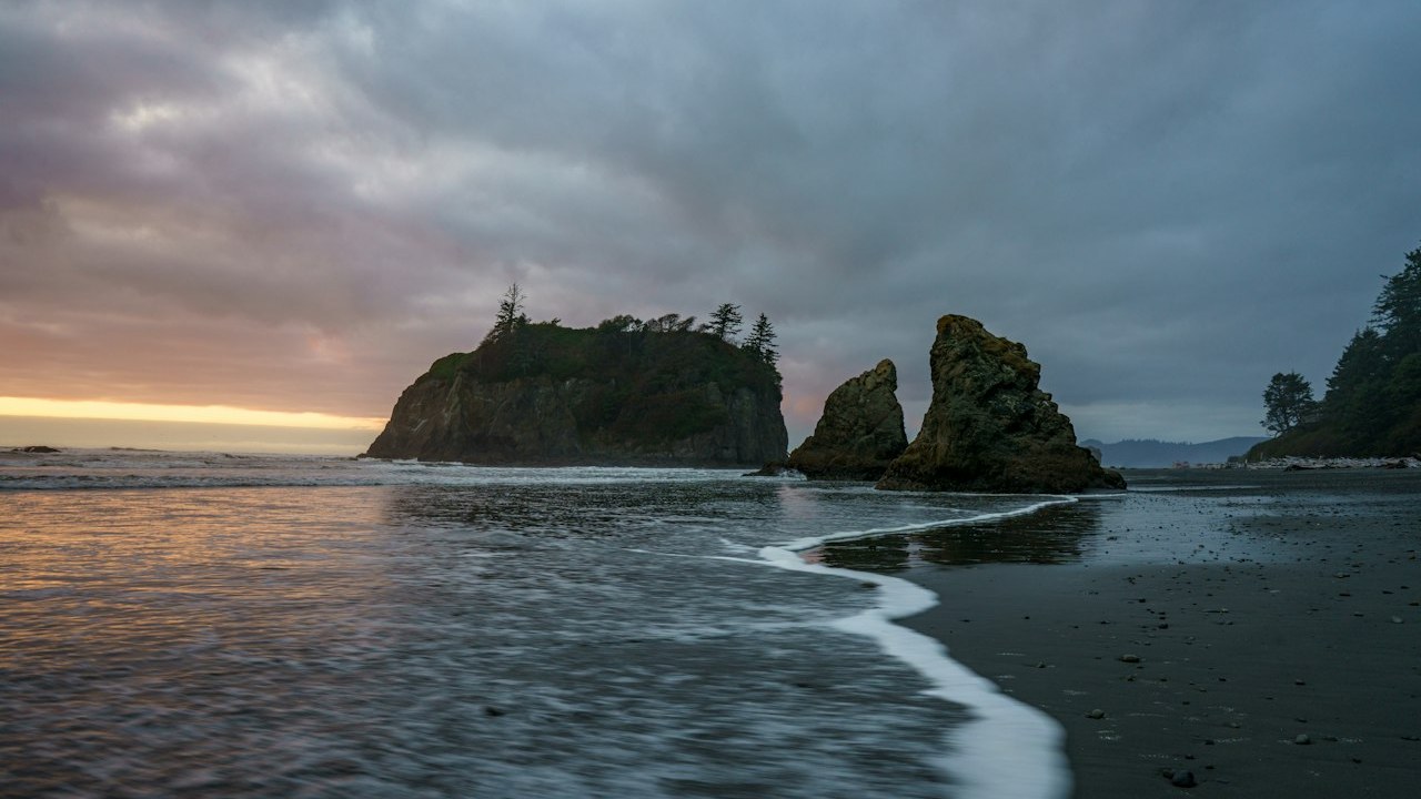
6. Ruby Beach & Sea Stacks
A wildly dramatic coastal landscape where jagged marine sea stacks (Abbey Island), towering cedar driftwood piles, and scarlet-tinted garnet sand meet the surging breakers of the open Pacific Ocean.
Why It's Breathtaking: Millions of years of relentless wave erosion have carved tectonic sedimentary rock into solitary sea monoliths, while winter Pacific storms deposit massive ancient tree trunks along the tide line.
How to Reach & Explore:
- Follow the gentle 0.25-mile trail from the bluff parking lot down through coastal spruce trees to the mouth of Cedar Creek.
- Carefully cross the natural bridge of weathered driftwood logs that separates the freshwater creek from the salt-spray beach.
- Walk north toward Abbey Island at low tide to explore vibrant intertidal marine colonies of ochre sea stars, green anemones, and gooseneck barnacles.
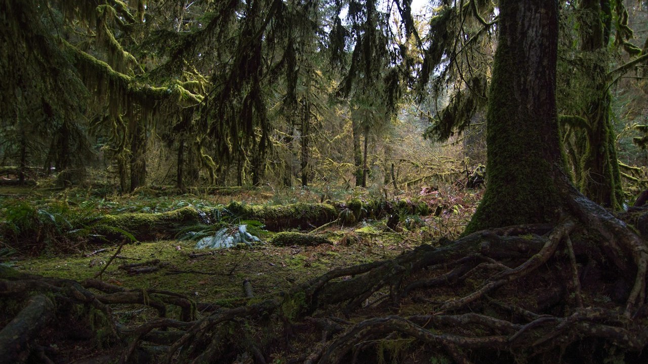
7. Hoh Rain Forest & Hall of Mosses
One of North America's most celebrated temperate rainforests, nourished by 140 inches of annual precipitation, where colossal Sitka spruce and western hemlocks are draped in curtains of green and golden club moss.
Why It's Breathtaking: The unique microclimate trapped between the Pacific Ocean and the Olympic Mountains creates perpetual atmospheric moisture, fostering ancient trees that reach over 250 feet in height and 500 years of age.
How to Reach & Explore:
- Arrive at the Hoh Rain Forest entrance station before 8:30 AM during peak summer to avoid multi-hour vehicle queues along Upper Hoh Road.
- Walk the flat, enchanting 0.8-mile Hall of Mosses Loop, pausing beneath towering bigleaf maples whose enormous limbs form natural moss-hung cathedral vaults.
- Continue onto the 1.2-mile Spruce Nature Trail along the braided, milky glacial waters of the Hoh River to spot wild Roosevelt elk grazing in meadows.
Marmot Precip Eco Waterproof Rain Jacket
Continuous precipitation barrier in a 140-inch temperate rainforest
8. Hurricane Ridge Overlook
A jaw-dropping subalpine panoramic ridge in Olympic National Park, offering sweeping views of Mount Olympus (7,980 ft), jagged glaciated jagged peaks, deep forested river valleys, and subalpine wildflower meadows.
Why It's Breathtaking: Perched thousands of feet above Port Angeles, Hurricane Ridge is the most accessible high-alpine viewpoint in the Olympics, accessible via a paved 17-mile mountain road.
How to Reach & Explore:
- Drive the winding scenic road from Port Angeles up through misty subalpine fir zones to the Hurricane Ridge parking terrace.
- Walk the paved 0.5-mile Meadow Loop Trail to spot endemic Olympic marmots sunning themselves on rocky outcroppings.
- Hike the 1.6-mile trail out to the summit of Hurricane Hill (5,757 ft) for 360-degree vistas across the Strait of Juan de Fuca to Vancouver Island, Canada.
9. Lake Crescent & Marymere Falls
A pristine, 624-foot-deep glacially carved lake renowned for its surreal cobalt and turquoise transparency, bordered by sheer forested mountain walls and mossy waterfall grottos.
Why It's Breathtaking: Because the lake water lacks nitrogen and other nutrients, phytoplankton cannot thrive, yielding exceptionally clear water that allows submerged logs to be seen dozens of feet below the glassy surface.
How to Reach & Explore:
- Begin at the historic Lake Crescent Lodge, strolling along the cedar dock to admire the mirror-like reflections of Mount Storm King in the blue water.
- Hike the gentle 1.8-mile round-trip forested trail through old-growth cedar and hemlock to Marymere Falls, a 90-foot plunge into a fern-fringed rock basin.
- Adventurous hikers can tackle the steep, rope-assisted trail up Mount Storm King for an unforgettable bird's-eye view looking straight down into the turquoise lake.
10. Cape Flattery & Makah Cultural Trail
The dramatic northwesternmost point of the contiguous United States, where ancient coastal forests meet churning Pacific swells that crash into sea caves and surge past Tatoosh Island Lighthouse.
Why It's Breathtaking: This sacred territory of the Makah Nation marks the wild geographical boundary where the open Pacific Ocean forces its way into the Strait of Juan de Fuca through sea stacks and underwater caverns.
How to Reach & Explore:
- Purchase a Makah Recreation Pass at the museum or general store in the coastal village of Neah Bay before heading to the trailhead.
- Walk the 0.75-mile boardwalk trail through coastal cedar and spruce bogs, stepping onto elevated wooden observation decks cantilevered over sheer sea cliffs.
- Look through spotting scopes out toward Tatoosh Island to observe nesting tufted puffins, sea otters playing in kelp beds, and migrating gray whales.
Geographic Zone: Mount Rainier & South Cascades
11. Mount Rainier - Paradise & Skyline Trail
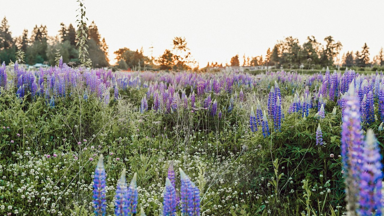
The legendary crown jewel of the Cascade volcanic arc: a 14,411-foot glaciated active stratovolcano rising directly above kaleidoscopic subalpine wildflower meadows, roaring glacial streams, and icefalls.
Why It's Breathtaking: Home to 25 major named glaciers—the most glaciated peak in the lower 48 states—Mount Rainier creates its own subalpine weather patterns and displays extraordinary floral diversity from July through August.
How to Reach & Explore:
- Verify your timed-entry reservation window for the Paradise corridor (SR-706) if visiting between late May and September during peak hours (7:00 AM – 3:00 PM).
- Begin the 5.5-mile Skyline Trail loop clockwise from the historic Paradise Inn, ascending past Myrtle Falls toward Panorama Point.
- Take in sweeping panoramic vistas at Panorama Point (6,800 ft), gazing across the Nisqually Glacier directly at Mount Adams, Mount St. Helens, and Mount Hood in Oregon.
Salomon Quest 4 Gore-Tex Backpacking Boots
Rigid ankle support and snow/rock traction on Skyline Trail alpine scree
Mount Rainier National Park Day Tour from Seattle
Transit and guided access for travelers without a rental vehicle
12. Mount Rainier - Sunrise & Mount Fremont Lookout
The highest point accessible by vehicle in Mount Rainier National Park, situated on the arid northeastern flank, offering a stark, lunar subalpine landscape gazing directly at the massive Emmons Glacier.
Why It's Breathtaking: Sitting in the rain shadow of Mount Rainier, Sunrise receives significantly less precipitation than Paradise, creating a completely different ecosystem of sparse whitebark pines and alpine tundra.
How to Reach & Explore:
- Drive the winding White River road up to Sunrise Lodge, setting out on the trail toward Sourdough Ridge in the crisp dawn chill.
- Hike the 5.6-mile round-trip trail out to the historic 1934 Mount Fremont Fire Lookout, perching at 7,181 feet above sea level.
- Scan the steep scree fields below the fire lookout for mountain goat herds grazing on subalpine lichens in early morning peace.
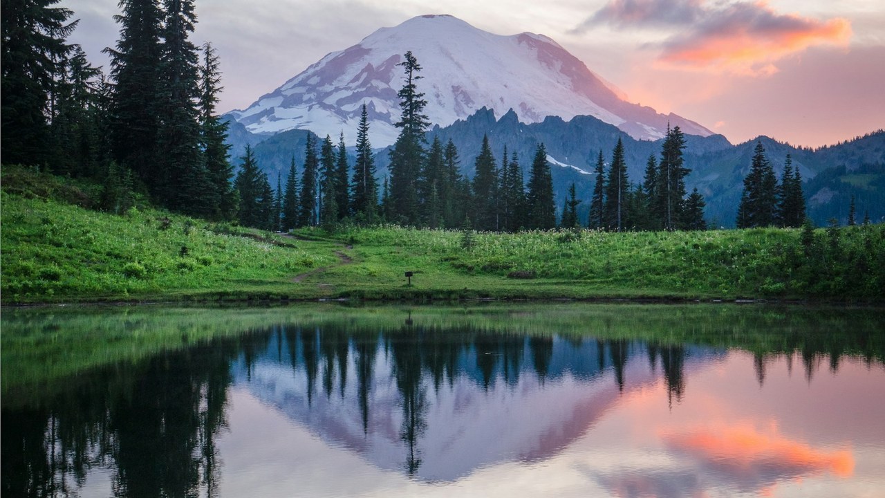
13. Reflection Lakes & Pinnacle Peak
A cluster of subalpine lakes situated along Stevens Canyon Road that provide the definitive, world-famous mirror reflection of Mount Rainier's volcanic summit shimmering on calm waters.
Why It's Breathtaking: On clear, windless mornings before solar heating stirs valley thermal winds, the calm surface of Reflection Lake acts as a flawless natural glass pane reflecting 14,411 feet of glaciated ice.
How to Reach & Explore:
- Arrive at the lakeshore pullouts 30 minutes before sunrise when alpenglow lights the eastern glaciers of Rainier in delicate pink and gold.
- Walk the gentle trail along the northern shore to find compositions framing the snowcapped volcano through subalpine firs and blooming pink heather.
- Cross the road to hike the 2.6-mile round-trip Pinnacle Peak Trail into the Tatoosh Range for an aerial view looking down at the lake chain.
14. Grove of the Patriarchs & Ohanapecosh
A protected ancient river island in the Ohanapecosh River that sheltered western red cedars and Douglas firs from catastrophic wildfires for over 1,000 years, growing tree trunks over 40 feet in circumference.
Why It's Breathtaking: Encircled by fast-flowing, crystal-clear glacial snowmelt, this island oasis created a natural fire barrier that allowed these ancient conifers to survive since the era of the early Middle Ages.
How to Reach & Explore:
- Follow the easy 1.5-mile loop path along the pristine turquoise waters of the Ohanapecosh River.
- Cross the single-file suspension bridge swinging above the river rapids to step onto the forested island sanctuary.
- Walk the elevated cedar boardwalk surrounding the massive twin Douglas firs, feeling the profound stillness of an intact 1,000-year-old temperate canopy.
15. Mount St. Helens - Johnston Ridge & Coldwater Lake
The dramatic ground zero of the catastrophic May 18, 1980 lateral volcanic eruption, where an entire mountainside collapsed in the largest landslide in recorded history, creating a profound, re-emerging post-volcanic landscape.
Why It's Breathtaking: Directly facing the gaping 2,000-foot-deep volcanic crater and active lava dome, Johnston Ridge offers an awe-inspiring, direct look into Earth's immense raw geological power and ecological rebirth.
How to Reach & Explore:
- Drive the scenic Spirit Lake Memorial Highway (SR-504) past the sediment retention dam and blast zone valley.
- Explore the interpretive trails along Coldwater Lake—a natural body of water formed when a massive volcanic debris avalanche dammed Coldwater Creek.
- Walk the Eruption Trail to examine blown-down forest logs and vibrant carpets of lupine and alder reclaiming the volcanic ash plains.
Geographic Zone: North Cascades & San Juan Islands
16. Diablo Lake Vista Point (SR-20)
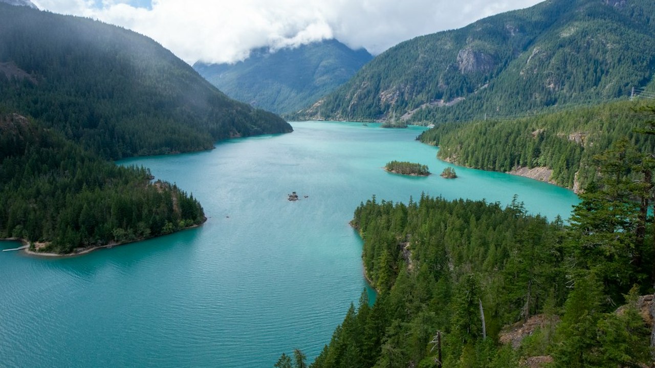
An astonishingly vivid neon-turquoise reservoir cradled between sheer glaciated granite peaks in North Cascades National Park, famously accessed via the iconic North Cascades Highway (SR-20).
Why It's Breathtaking: Surrounding glaciers grind mountain granite bedrock into microscopic 'rock flour'. Suspended in the water, these fine mineral particles scatter sunlight, producing an electric turquoise and emerald glow.
How to Reach & Explore:
- Drive east along SR-20 through the Skagit River gorge, pulling into the wide Diablo Lake Overlook at Milepost 132.
- Walk the stone parapet viewing platform to admire the stark color contrast between the turquoise lake and the dark green coniferous slopes of Colonial Peak.
- Drive down to the Colonial Creek campground shoreline to launch a kayak or paddleboard directly into the cold glacier-fed waters.
17. Washington Pass Overlook & Liberty Bell
The highest elevation point along the North Cascades Highway (SR-20), featuring soaring sheer granite spires, alpine larch groves, and sweeping views of the iconic Liberty Bell Mountain (7,720 ft).
Why It's Breathtaking: Ancient tectonic collisions uplifted immense granitic batholiths that were subsequently sculpted by alpine glaciers into vertical, dizzying spire walls resembling the European Dolomites.
How to Reach & Explore:
- Pull into the Washington Pass Overlook parking area and follow the paved 0.25-mile accessible trail through stunted subalpine firs.
- Step out onto the railed granite viewing platform perched hundreds of feet sheer above the sweeping hairpin curve of Highway 20 below.
- Admire the soaring granite face of Liberty Bell Mountain and Early Winters Spires glowing warm amber in late afternoon light.
18. Stehekin Valley & Lake Chelan (No Road Access)
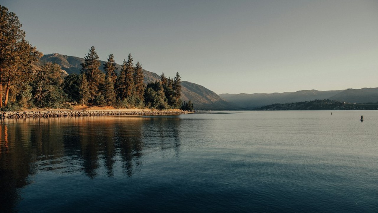
A secluded paradise at the remote northern tip of 55-mile-long Lake Chelan. Stehekin is completely unconnected to the outside road network—accessible only by passenger ferry, floatplane, or hiking trails.
Why It's Breathtaking: Because no automobiles can reach Stehekin by highway, the valley retains an extraordinary, peaceful 19th-century wilderness atmosphere surrounded by glaciated 8,000-foot peaks.
How to Reach & Explore:
- Board the Lady of the Lake passenger ferry or the Stehekin Ferry from the town of Chelan for a scenic 2.5-hour cruise up the fjord-like lake.
- Disembark at Stehekin Landing and rent a bicycle or take the red shuttle bus 2 miles up the quiet gravel road to the historic Stehekin Pastry Company.
- Hike the gentle path to Rainbow Falls, a 312-foot thundering cascade plunging down sheer granite ledges into lush misty cedar groves.
19. Friday Harbor & San Juan Island (Lime Kiln Whale Watch)
The historic harbor hub of the San Juan archipelago, famed for resident and transient orca pods, harbor porpoises, historic lighthouses, and the shoreline viewing rocks of Lime Kiln Point State Park.
Why It's Breathtaking: Deep underwater marine trenches run directly along the western shore of San Juan Island, allowing migrating killer whales to hunt salmon just yards from shoreline rocks.
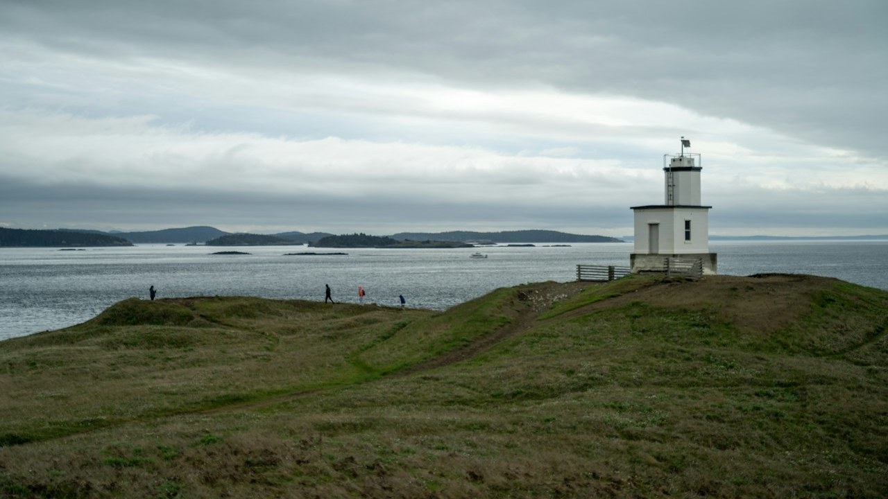
How to Reach & Explore:
- Catch the scenic WSDOT car ferry from Anacortes, weaving through emerald islands to dock at picturesque Friday Harbor.
- Drive 15 minutes across the island to Lime Kiln Point State Park ('Whale Watch Park'), finding a flat shoreline rock ledge above the kelp beds.
- Book a guided whale-watching and marine wildlife tour from Friday Harbor marina to respectfully observe orcas and humpbacks in the Salish Sea.
20. Orcas Island & Mount Constitution (Moran State Park)
The highest vantage point in the San Juan Islands, crowned by a historic 1936 stone observation tower modeled after 12th-century medieval watchtowers in the Caucasus mountains.
Why It's Breathtaking: From the summit stone tower, visitors enjoy an unmatched 360-degree aerial panorama encompassing Mount Baker, Mount Rainier, Vancouver Island, and the entire maze of the San Juan archipelago.
How to Reach & Explore:
- Take the WSDOT ferry to Orcas Island and drive through Eastsound village to Moran State Park.
- Drive or hike the scenic mountain road ascending through dense hemlock forests to the summit of Mount Constitution.
- Climb the winding interior stone stairs of the lookout tower to gaze out across water passages dotted with emerald islands and ferry wakes.
Geographic Zone: Central & Eastern Washington
21. Palouse Falls State Park (Zero Commercial Forcing)
Washington's official state waterfall—a stunning 198-foot cataract plunging into a deep churning basalt bowl carved by prehistoric Ice Age Missoula Floods in the remote channeled scablands.
Why It's Breathtaking: Roughly 13,000 years ago, catastrophic glacial lake outburst floods surged across eastern Washington, ripping through hundreds of feet of solid Columbia River basalt to create this desert canyon wonder.
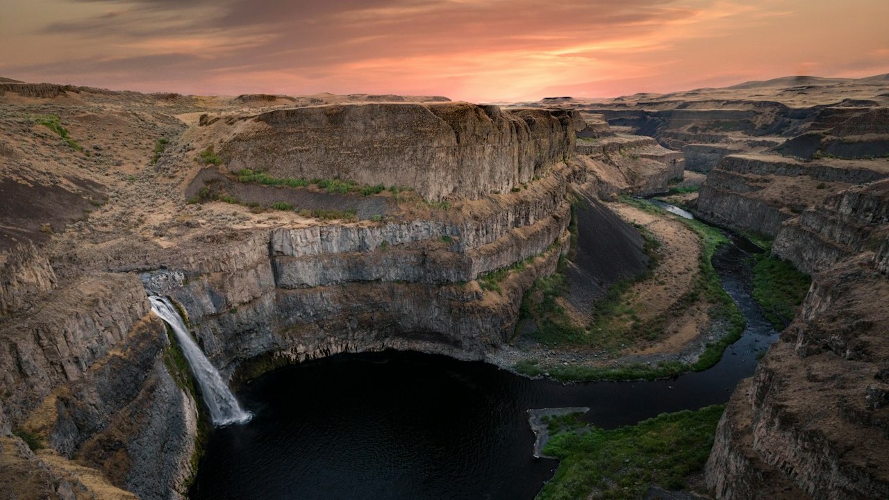
How to Reach & Explore:
- Purchase a Washington State Discover Pass and drive SR-261 into the rugged scablands of Franklin and Whitman counties.
- Walk the paved overlook path from the main parking terrace to capture the full 198-foot plunge framed by towering columnar basalt canyon walls.
- Visit in late spring (May – early June) when Palouse River snowmelt is running at peak volume and the canyon rim is covered in yellow desert parsley.
22. Columbia River Gorge - Beacon Rock & Cape Horn
The monolithic volcanic core of an ancient basalt volcano rising 848 feet sheer from the banks of the Columbia River, featuring an ingenious 1918 switchback trail anchored by 52 handrails.
Why It's Breathtaking: Carved by the catastrophic Ice Age floods, the Columbia River Gorge cuts a sea-level pass straight through the Cascade mountain barrier, creating dynamic thermal winds and towering river bluffs.
How to Reach & Explore:
- Drive scenic Highway 14 along the Washington side of the gorge to Beacon Rock State Park.
- Ascend the engineered 0.75-mile trail with its 52 switchbacks, wooden catwalks, and safety handrails clinging directly to the sheer vertical monolith.
- Reach the summit terrace for an unforgettable panorama looking east toward the Bridge of the Gods and west toward Portland.
23. Leavenworth Bavarian Village & Icicle Gorge
A charming Bavarian-themed alpine village nestled in the foothills of the Cascades along the Wenatchee River, famous for timbered architecture, craft breweries, and access to the rugged Alpine Lakes Wilderness.
Why It's Breathtaking: In the 1960s, town leaders transformed a dying logging community into an authentic Bavarian alpine retreat framed by the dramatic, jagged sawtooth ridge of the Enchantments and Icicle Ridge.
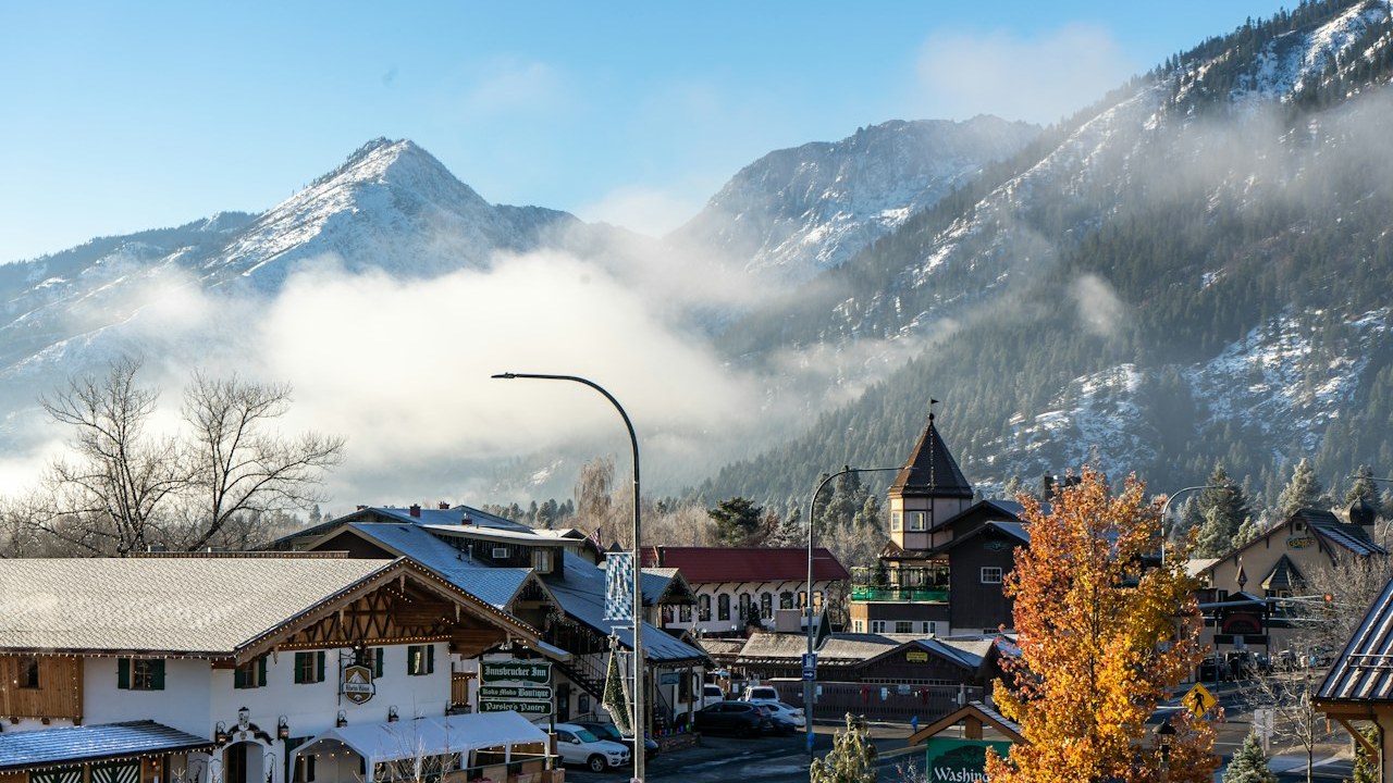
How to Reach & Explore:
- Stroll Front Street to enjoy Bavarian soft pretzels, bratwurst, and European lager while admiring alpine architecture and flower boxes.
- Drive 15 minutes up Icicle Road to hike the peaceful 4.2-mile Icicle Gorge loop trail winding alongside roaring glacial river rapids.
- Rent a tube or raft in mid-summer for a relaxing, scenic float down the clear waters of the Wenatchee River through the center of town.
24. Lake Wenatchee State Park
A spectacular 5-mile-long glacial lake framed by towering Cascade peaks, offering a pristine sandy beach, clear swimming waters, and views looking toward Dirtyface Peak.
Why It's Breathtaking: Fed by the pristine glacial waters of the White River and Chiwawa River, Lake Wenatchee serves as a natural gateway between high alpine Cascade passes and the sunny eastern slopes.
How to Reach & Explore:
- Head to the South Beach day-use area to walk the wide, natural sandy shoreline and dip your feet in crisp mountain water.
- Rent a stand-up paddleboard or kayak from the park concession to paddle into quiet forested bays along the western shore.
- Hike the forested trails through mixed Douglas fir and ponderosa pine, listening to the distinctive mountain birds of the eastern Cascades.
25. Dry Falls & Grand Coulee Heritage Area
The astonishing skeletal canyon of what was once the largest waterfall on planet Earth—a 3.5-mile-wide, 400-foot-high cliff face that dwarfed Niagara Falls during the Ice Age Missoula Floods.
Why It's Breathtaking: During the height of the Ice Age cataclysms, floodwaters over 300 feet deep cascaded over this horseshoe cliff at 65 miles per hour—ten times the combined flow of all the world's rivers today.
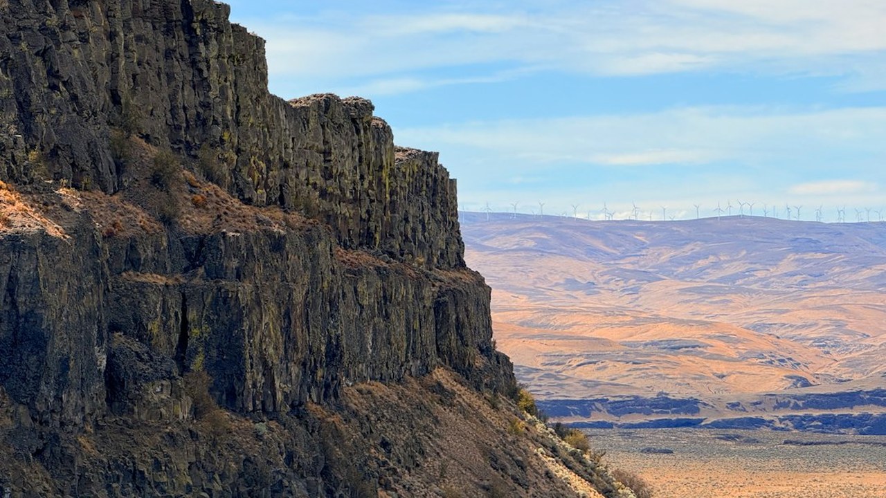
How to Reach & Explore:
- Visit the Dry Falls Visitor Center perched directly on the cliff rim along SR-17 to view dramatic geological exhibits explaining the Missoula Floods.
- Stand at the stone vista point and look down at the deep blue plunge-pool lakes (Sun Lakes) sitting 400 feet below where thundering waterfalls once crashed.
- Drive down into Sun Lakes-Dry Falls State Park to camp, hike, or paddle beneath the sheer, towering basalt amphitheater cliffs.
Two Curated Washington Road Trip Itineraries
If you prefer a seamless, connected multi-day journey rather than standalone destinations, here are two realistic, logistically validated road trip loops that minimize backtracking and respect physical travel barriers:
Route 1: The 5-Day Olympic Wilderness & Coast Loop
Recommended Duration: 5 Days / 4 Nights • Total Driving: ~380 Miles • Transit: Rental Car + Seattle-Bainbridge Ferry
- Day 1: Board the morning ferry from Seattle Pier 52 to Bainbridge Island → Explore Winslow → Scenic drive along US-101 to Port Angeles → Afternoon ascent to Hurricane Ridge Overlook. Overnight: Port Angeles.
- Day 2: Morning walk along Lake Crescent → Hike to Marymere Falls → Afternoon journey out to Cape Flattery at the northwestern tip of the United States. Overnight: Forks / Sekiu.
- Day 3: Early morning arrival (before 8:30 AM) at the Hoh Rain Forest to walk the Hall of Mosses in tranquil mist → Late afternoon tide exploration among sea stacks at Ruby Beach. Overnight: Kalaloch / Lake Quinault.
- Day 4: Morning walk through ancient Quinault rainforest groves → Scenic coastal drive southward along US-101 → Evening transit through Olympia back toward Seattle.
- Day 5: Return to Seattle waterfront → Sunset stroll across Elliott Bay Pier 62.
Route 2: The 4-Day Cascade Crest & Mountain Loop
Recommended Duration: 4 Days / 3 Nights • Total Driving: ~420 Miles • Transit: Drive via SR-20 & US-2 (Seasonal May–Oct)
- Day 1: Depart Seattle along I-5 North → Turn east on SR-20 (North Cascades Highway) → Mid-day panorama at neon-turquoise Diablo Lake Vista Point → Afternoon overlook at Washington Pass under Liberty Bell Mountain. Overnight: Winthrop.
- Day 2: Morning drive south to Lake Chelan → Board the Lady of the Lake passenger ferry to the roadless sanctuary of Stehekin → Visit Rainbow Falls and the Stehekin Pastry Company. Overnight: Stehekin or Chelan.
- Day 3: Cruise back down Lake Chelan → Scenic drive along the Columbia and Wenatchee rivers into Bavarian Leavenworth → Icicle Gorge evening walk. Overnight: Leavenworth.
- Day 4: Morning paddle at Lake Wenatchee State Park → Scenic alpine drive over Stevens Pass (US-2) returning to Seattle.
Washington State Essential Packing Checklist
Because maritime coastal fog, alpine snowfields, and semi-arid scabland heat can all occur in the same 4-day trip, packing modular layers is essential for comfort and safety:
1. Weather Protection & Layers
- Breathable waterproof shell (Gore-Tex or equivalent 2.5/3-layer)
- Mid-weight fleece or packable down insulator jacket
- Moisture-wicking merino wool or synthetic base layers (no cotton)
- Wide-brim sun hat and UV-protective polarized sunglasses
2. Footwear & Trail Hardware
- Waterproof hiking boots with aggressive multidirectional lugs
- Collapsible trekking poles with carbide tips and rubber caps
- Merino wool hiking socks (pack at least 3 pairs to keep feet dry)
- Traction microspikes for early summer alpine trails at Paradise
3. Navigation & Passes
- America the Beautiful National Parks Pass
- Washington State Discover Pass (for State Parks & DNR lands)
- Downloaded offline topographic maps (zero cellular in Olympic/Cascades)
- Backup portable power bank (10,000–20,000 mAh) for mobile phones
Frequently Asked Questions About Washington Travel
What is the absolute best time of year to visit Washington State?
Mid-July through late September is universally considered the prime travel window. During these two months, subalpine snow melts from mountain trails like Mount Rainier's Skyline Trail, high-altitude passes (SR-20 North Cascades Highway) are fully open, wildflower blooms peak, and the Puget Sound enjoys long, warm, sun-filled days with minimal rain.
Do I need a rental car to explore Washington State?
For downtown Seattle and Bainbridge Island, public transit (Sound Transit light rail, Seattle Streetcar, and Washington State Ferries) is seamless without a vehicle. However, to visit the Olympic Peninsula, North Cascades, and Mount Rainier, a rental vehicle is strongly recommended. Alternatively, travelers without a vehicle can book guided day excursions departing directly from downtown Seattle hotels to destinations like Mount Rainier.
What park passes do I need for these 25 destinations?
You will primarily need two passes: the federal America the Beautiful Interagency Pass ($80/year), which covers Mount Rainier, Olympic, and North Cascades National Parks as well as Mount St. Helens; and the state Washington Discover Pass ($30/annual or $10/day), required for Washington State Parks such as Palouse Falls, Lake Wenatchee, Beacon Rock, and Moran State Park.
Can you actually drive all the way to Stehekin?
No. Stehekin has no outside road connections whatsoever. The valley is surrounded by rugged Cascade wilderness. Visitors must take the Lady of the Lake passenger ferry or Stehekin Ferry from the town of Chelan, fly in via floatplane, or hike over rugged mountain passes like Cascade Pass.
Final Thoughts: Embracing the Wild Pacific Northwest
Washington State rewards those who respect its immense scale and variable weather. Whether you find yourself enveloped in the profound emerald hush of the Hoh Rain Forest, watching alpenglow illuminate the glaciers of Mount Rainier from Reflection Lake, or listening to orca blows from the rocky ledges of San Juan Island, the Pacific Northwest leaves an indelible mark on every traveler.
By grouping your journey into regional clusters, preparing for maritime and alpine microclimates with reliable layers, and giving yourself ample time to sit by wild rivers and tidal shores, your visit to these 25 stunning places will become an unforgettable journey through one of the most magnificent landscapes on Earth.
Plan Your Washington State Trip: Stays, Guided Experiences & Gear
Tap your travel style below for a personalized match, or lock in refundable accommodation rates and skip-the-line attraction tickets (powered by Viator, a Tripadvisor company) before peak dates sell out:


Comments