30 Bucket List Family Road Trips in America (2026): Scenic Highlights, Family Waypoints & Route Guidance
30 Bucket List Family Road Trips in America (2026): Scenic Highlights, Family Waypoints & Route Guidance
Embarking on a family road trip across America offers a memorable convergence of vast geographic scale, ever-changing geological wonders, and cherished shared memories. From the rugged ocean cliffs of California's Pacific Coast Highway to the misty mountain crests of the Blue Ridge Parkway and the red rock canyons of the Desert Southwest, this authoritative guide profiles thirty bucket-list family journeys across the United States. Each route highlights practical driving hours, engaging stops for children of all ages, essential scenic turnouts, and candid operational tips to ensure a safe, restful, and deeply rewarding family adventure.
Disclosure: This guide contains independently selected editorial recommendations. When you book a tour or purchase travel equipment through our verified affiliate links, we may earn an affiliate commission at no extra cost to you.
Successful multi-generational road trips demand a thoughtful balance between scenic ambitions and family pacing. Rather than attempting to log eight grueling hours behind the wheel daily, seasoned traveling families cap driving stints at two to three hours between meaningful leg-stretching stops. Incorporating state parks, visitor center junior ranger programs, and accessible short nature loops transforms long transit corridors into active outdoor discovery.
Family Stewardship & Leave No Trace Principles
Traveling through pristine natural corridors presents a wonderful opportunity to teach children land stewardship. Stay on marked boardwalks and designated trails to protect fragile subalpine meadows and desert cryptobiotic soils. Pack out all picnic trash, observe wildlife from recommended park safety distances (at least 100 yards from bears and wolves, and 25 yards from bison and elk), and respect regional campfire regulations to preserve these lands for future generations.
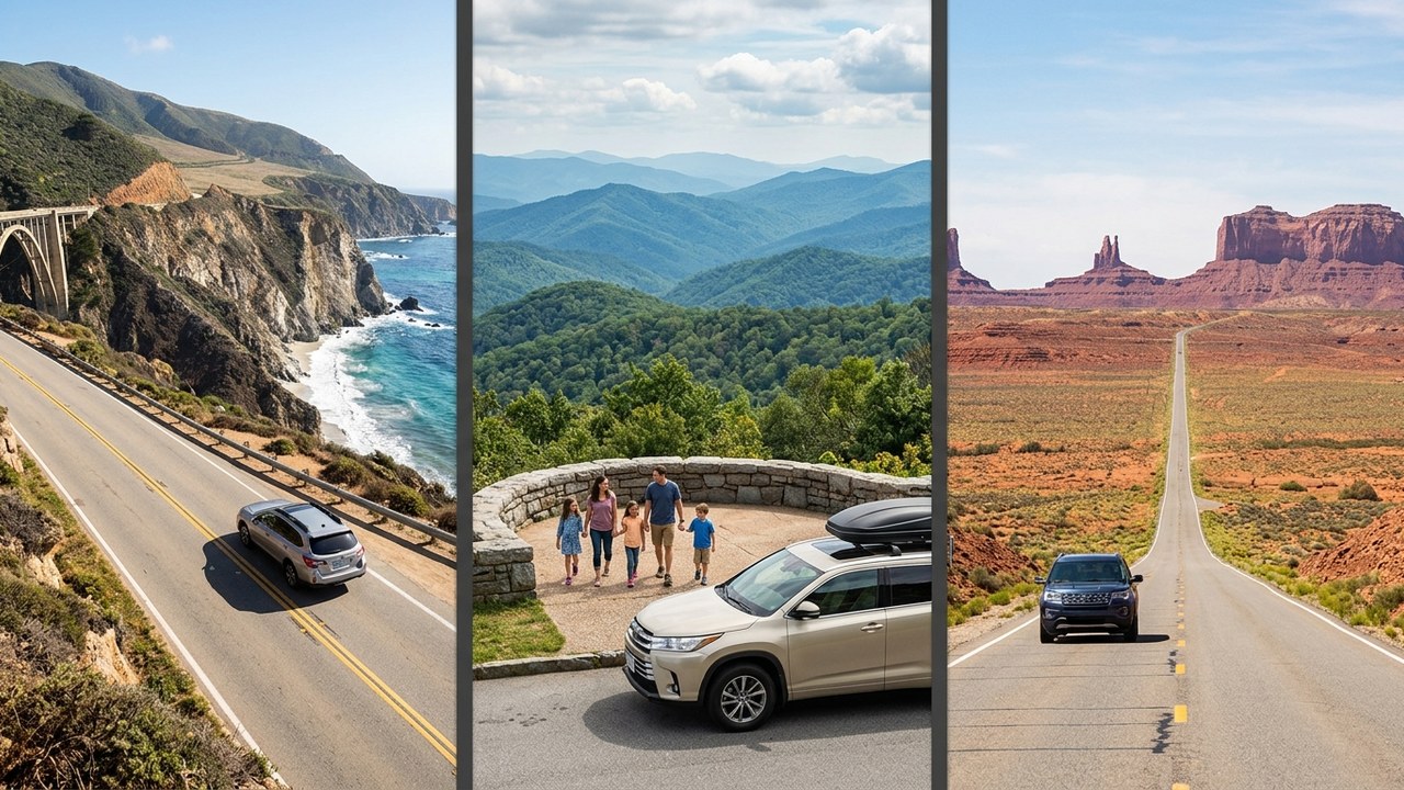
In This Guide
- Pacific Coast Highway (California State Route 1)
- Blue Ridge Parkway (Virginia to North Carolina)
- Going-to-the-Sun Road (Glacier National Park)
- Historic Route 66 Heartland Trail
- Overseas Highway (Florida Keys Scenic Highway)
- Utah's Scenic Byway 12 (All-American Road)
- Great River Road (Upper Mississippi River Valley)
- Columbia River Gorge Historic Highway
- Olympic Peninsula Loop (US Highway 101)
- Sedona to Grand Canyon via Oak Creek Canyon
- Yellowstone & Grand Teton Mountain Loop
- Road to Hana (Maui Coastal Highway)
- Kancamagus Scenic Byway (White Mountains)
- Park Loop Road & Acadia Coastline
- Badlands to Black Hills Circuit
- Million Dollar Highway (San Juan Skyway)
- Lake Superior Circle Tour (North Shore & UP)
- Shenandoah Skyline Drive
- Red Rock Scenic Byway & Grand Staircase
- Outer Banks National Scenic Byway (NC-12)
- Tioga Pass & Eastern Sierra Corridor (CA-120)
- Natchez Trace Parkway
- Texas Hill Country Willow City & River Loop
- Cascade Loop Scenic Highway (WA-20 & US-2)
- Door County Coastal Byway (WI-42 & 57)
- Trail of the Mountain Spirits (Gila Wilderness)
- Finger Lakes Scenic Byway (NY-14 & Route 89)
- Seward Highway & Kenai Peninsula (AK-1)
- Talimena National Scenic Byway
- Enchanted Circle Scenic Byway
Complete 30 Family Road Trips Master Comparison Table
| # | Scenic Road Trip | State / Region | Route Distance | Recommended Family Pace |
|---|---|---|---|---|
| 1 | Pacific Coast Highway (California State Route 1) | California | 125 miles (200 km) | 2 to 3 days |
| 2 | Blue Ridge Parkway (Virginia to North Carolina) | Virginia / North Carolina | 469 miles (755 km) | 4 to 5 days |
| 3 | Going-to-the-Sun Road (Glacier National Park) | Montana | 50 miles (80 km) | 1 to 2 days |
| 4 | Historic Route 66 Heartland Trail | Illinois to Missouri / Oklahoma | 700 miles (1,125 km) | 4 to 6 days |
| 5 | Overseas Highway (Florida Keys Scenic Highway) | Florida | 113 miles (182 km) | 2 to 3 days |
| 6 | Utah's Scenic Byway 12 (All-American Road) | Utah | 124 miles (200 km) | 2 to 3 days |
| 7 | Great River Road (Upper Mississippi River Valley) | Minnesota to Wisconsin / Iowa | 320 miles (515 km) | 3 to 4 days |
| 8 | Columbia River Gorge Historic Highway | Oregon / Washington | 70 miles (112 km) | 1 to 2 days |
| 9 | Olympic Peninsula Loop (US Highway 101) | Washington | 330 miles (530 km) | 3 to 5 days |
| 10 | Sedona to Grand Canyon via Oak Creek Canyon | Arizona | 110 miles (177 km) | 2 days |
| 11 | Yellowstone & Grand Teton Mountain Loop | Wyoming / Montana | 250 miles (400 km) | 4 to 6 days |
| 12 | Road to Hana (Maui Coastal Highway) | Hawaii | 52 miles (84 km) | 1 to 2 days |
| 13 | Kancamagus Scenic Byway (White Mountains) | New Hampshire | 34.5 miles (55.5 km) | 1 to 2 days |
| 14 | Park Loop Road & Acadia Coastline | Maine | 27 miles (43 km) | 2 to 3 days |
| 15 | Badlands to Black Hills Circuit | South Dakota | 180 miles (290 km) | 3 to 4 days |
| 16 | Million Dollar Highway (San Juan Skyway) | Colorado | 70 miles (112 km) | 2 to 3 days |
| 17 | Lake Superior Circle Tour (North Shore & UP) | Michigan / Minnesota | 450 miles (724 km) | 4 to 6 days |
| 18 | Shenandoah Skyline Drive | Virginia | 105 miles (169 km) | 2 to 3 days |
| 19 | Red Rock Scenic Byway & Grand Staircase | Arizona to Utah | 215 miles (346 km) | 3 to 4 days |
| 20 | Outer Banks National Scenic Byway (NC-12) | North Carolina | 115 miles (185 km) | 3 to 4 days |
| 21 | Tioga Pass & Eastern Sierra Corridor (CA-120) | California | 140 miles (225 km) | 2 days |
| 22 | Natchez Trace Parkway | Tennessee to Mississippi | 444 miles (715 km) | 3 to 5 days |
| 23 | Texas Hill Country Willow City & River Loop | Texas | 160 miles (257 km) | 2 to 3 days |
| 24 | Cascade Loop Scenic Highway (WA-20 & US-2) | Washington | 440 miles (708 km) | 3 to 5 days |
| 25 | Door County Coastal Byway (WI-42 & 57) | Wisconsin | 66 miles (106 km) | 2 to 3 days |
| 26 | Trail of the Mountain Spirits (Gila Wilderness) | New Mexico | 93 miles (150 km) | 1 to 2 days |
| 27 | Finger Lakes Scenic Byway (NY-14 & Route 89) | New York | 120 miles (193 km) | 2 to 3 days |
| 28 | Seward Highway & Kenai Peninsula (AK-1) | Alaska | 127 miles (204 km) | 2 to 3 days |
| 29 | Talimena National Scenic Byway | Oklahoma to Arkansas | 54 miles (87 km) | 1 to 2 days |
| 30 | Enchanted Circle Scenic Byway | New Mexico | 84 miles (135 km) | 2 days |
1. Pacific Coast Highway (California State Route 1)
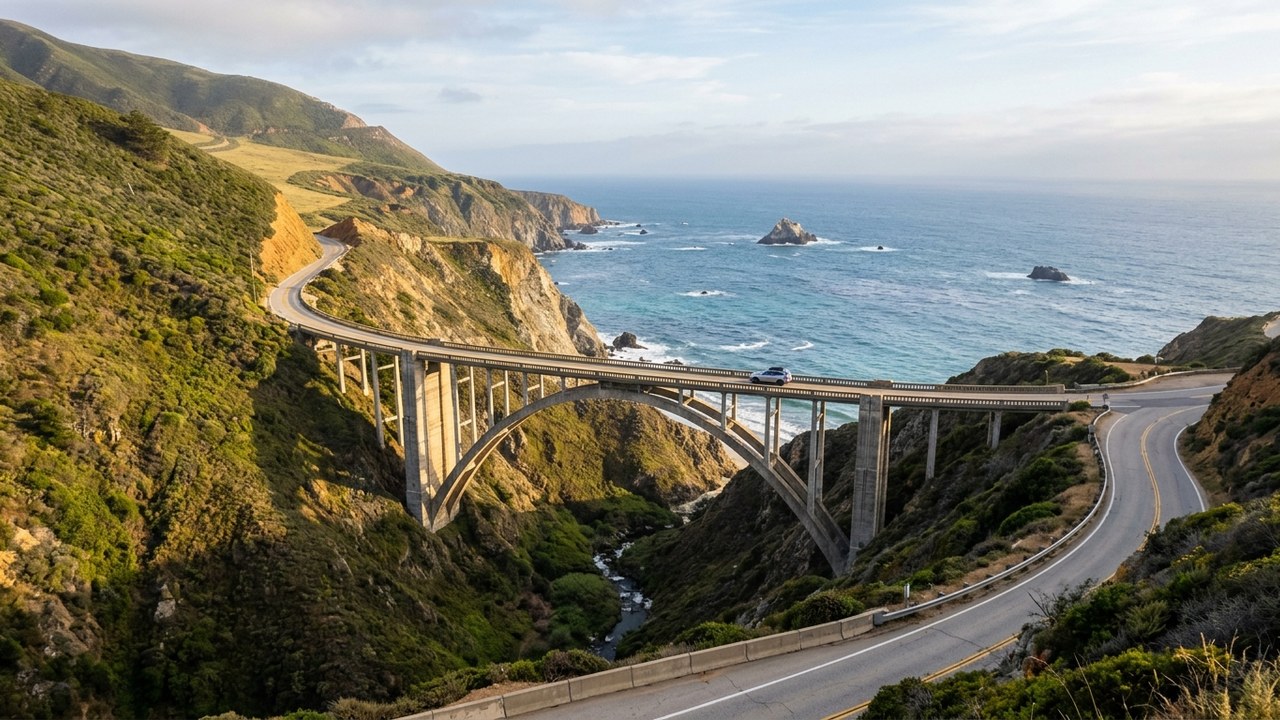
California's Highway 1 traces the dramatic collision of the Santa Lucia Mountains with the surging Pacific Ocean, delivering sweeping ocean panoramas at every bend.
Bixby Creek Bridge towers 260 feet above a crashing coastal canyon, offering iconic coastal photography vantage points for travelers.
Further south along the rugged coast near San Simeon, the Piedras Blancas rookery allows children to observe hundreds of massive northern elephant seals lounging directly on sandy beaches.
Monterey Whale Watching Tours
Compare half-day catamaran excursions departing Monterey's wharf to spot migrating humpbacks, blue whales, and sea otters along the deep canyon.
2. Blue Ridge Parkway (Virginia to North Carolina)
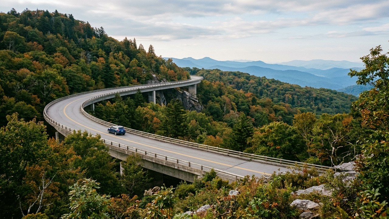
Weaving along the spine of the Appalachian Mountains, the Blue Ridge Parkway provides uninterrupted pastoral vistas without a single commercial billboard or traffic signal.
Historic Mabry Mill at Milepost 176 showcases a working 1910 water-powered gristmill where children can watch cornmeal being ground and taste fresh buckwheat pancakes.
The Linn Cove Viaduct sweeps gracefully around the rugged contours of Grandfather Mountain, engineering an elevated roadway that protects fragile alpine ecology.

Rexing V1P Pro Dual Dash Cam
Dual-channel dash camera records continuous 1080p front and rear video through winding mountain switchbacks with low-light night sensors.
Adhesive windshield mount and 12V vehicle power cable included.
I may earn a commission if you buy through this link.3. Going-to-the-Sun Road (Glacier National Park)
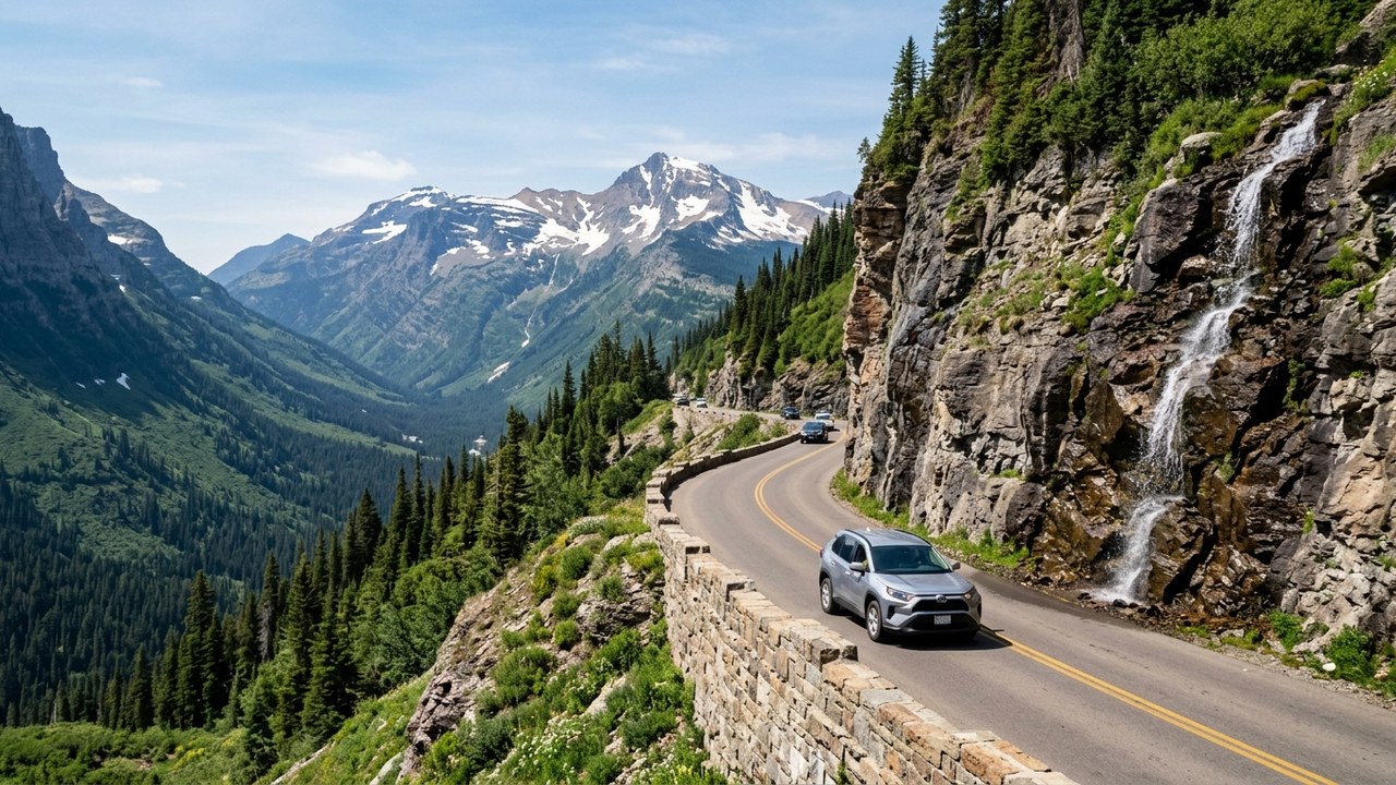
Carved directly into the sheer vertical mountain walls of Glacier National Park, this engineering marvel crosses the Continental Divide at 6,646-foot Logan Pass.
Glacial meltwaters cascade down weeping walls along the cliffside road, while Lake McDonald displays thousands of colorful submerged pebbles along its pebble beaches.
At Logan Pass, families frequently spot shaggy white mountain goats and bighorn sheep grazing calmly along the accessible boardwalk trail toward Hidden Lake Overlook.
Osprey Daypacks
Browse compact, ventilated daypacks designed for day hikes and family sightseeing, comparing packable fabrics and hydration sleeve options.
4. Historic Route 66 Heartland Trail
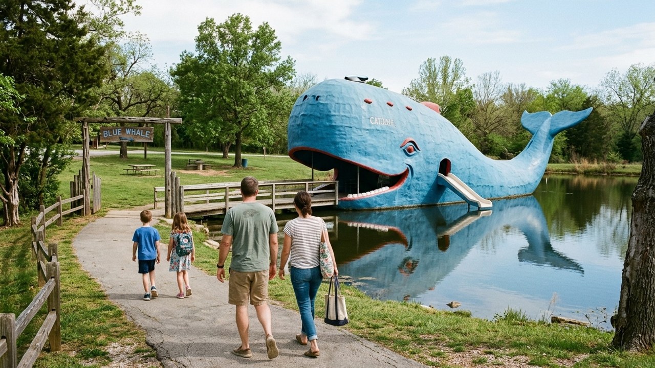
The Mother Road embodies the classic American road trip spirit, lined with nostalgic neon signs, vintage motor courts, and whimsical roadside attractions that enchant youngsters.
Meramec Caverns near Stanton, Missouri, guides families through illuminated underground limestone caverns once used as an outlaw hideout by Jesse James.
In Catoosa, Oklahoma, children can explore the famous 80-foot Blue Whale swimming dock, one of the most beloved open-air photo landmarks on Route 66.
Road Trip Coolers
Explore compact, insulated latching coolers built to keep family provisions, snacks, and water cold over long, hot open-highway stretches.
5. Overseas Highway (Florida Keys Scenic Highway)
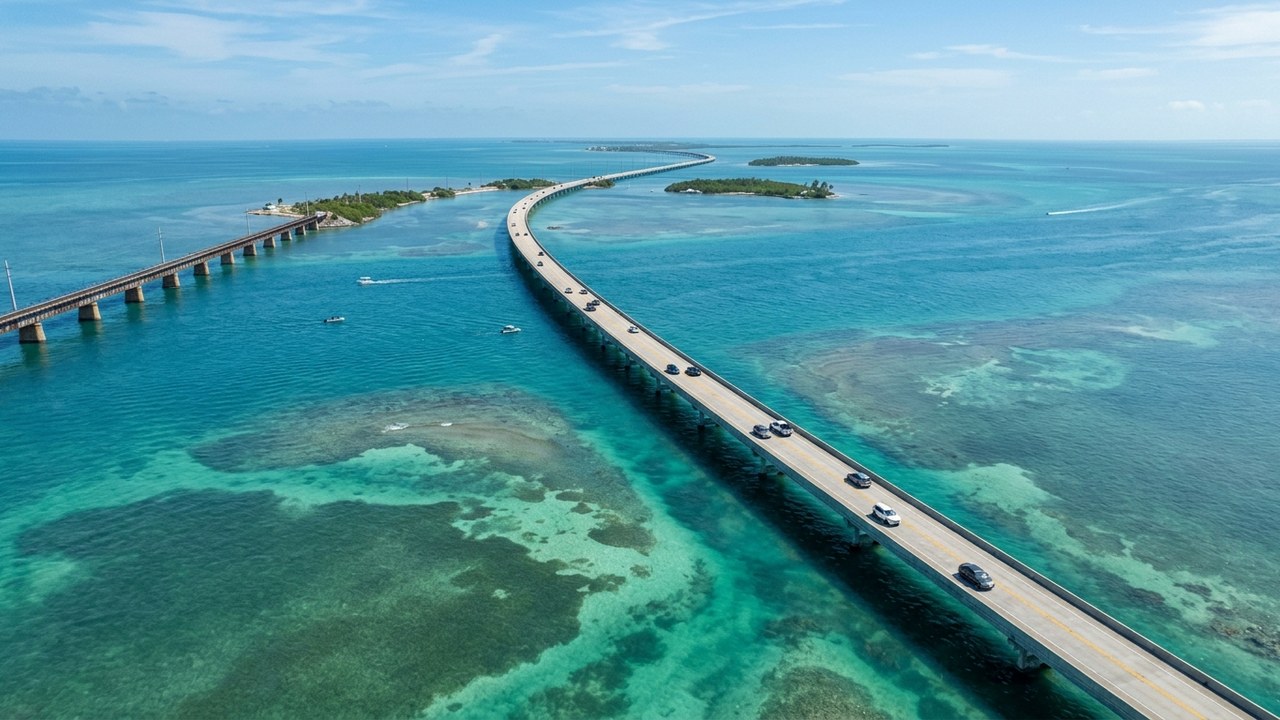
Leaping across 42 ocean bridges connecting the coral islands of the Florida Keys, the Overseas Highway creates the sensation of driving directly across the open Atlantic Ocean.
The Seven Mile Bridge delivers panoramic views of turquoise flats and ocean channels, while Bahia Honda State Park offers shallow, calm beaches ideal for toddler wading.
At Robbie's Marina in Islamorada, kids can hand-feed schooling six-foot silver tarpon from the low dock planks while pelicans wait patiently nearby.
Key West Snorkeling Tours
Compare catamaran sailing excursions and guided reef trips among living coral formations and marine wildlife before returning for sunset festivities.
6. Utah's Scenic Byway 12 (All-American Road)
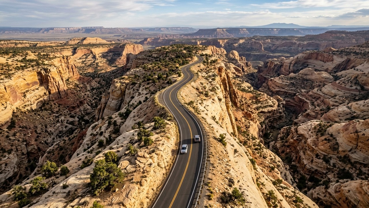
Traversing multi-hued slickrock canyons, juniper plateaus, and high alpine forests, Byway 12 connects two iconic national parks through breathtaking desert terrain.
The thrilling Hogback section carries travelers along a narrow sandstone ridge with sheer drop-offs plunging into deep canyon depths on both shoulders.
At Capitol Reef's historic Fruita district, families can pick fresh heritage peaches and apples from historic Mormon pioneer orchards.
Merrell Hiking Shoes
Browse trail shoes with grippy outsoles and water protection for slickrock scrambles, canyon paths, and scenic park overlooks.
7. Great River Road (Upper Mississippi River Valley)
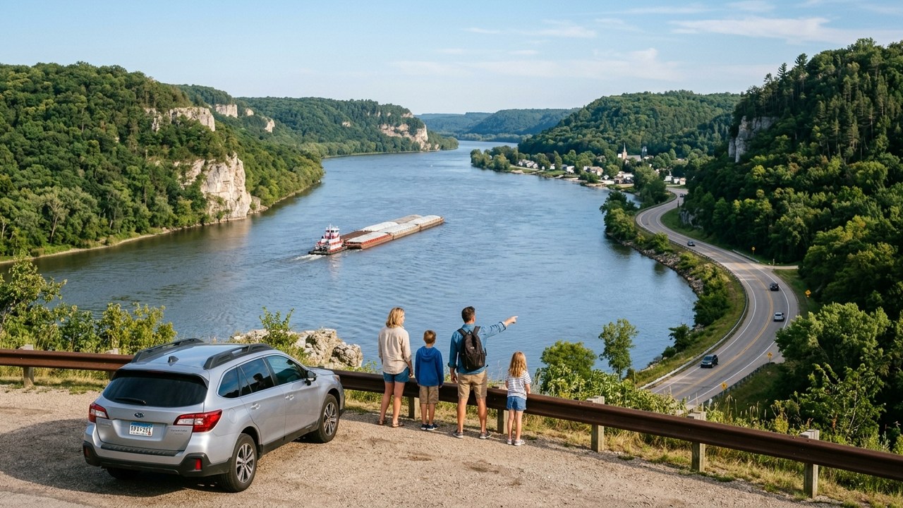
Tracing the majestic Mississippi River as it winds between towering limestone bluffs, this scenic byway reveals tranquil river towns, active barge locks, and rich wildlife.
At Itasca State Park in Minnesota, children can walk across the shallow, knee-deep stone headwaters where the mighty Mississippi River begins its journey.
The National Eagle Center in Wabasha, Wisconsin, provides up-close encounters with rescued bald eagles and observation decks overlooking soaring river raptors.
GetOut City Exploration Experiences
Self-guided outdoor escape games and walking quests turn city sights and historic downtown stops into interactive family adventures.
8. Columbia River Gorge Historic Highway
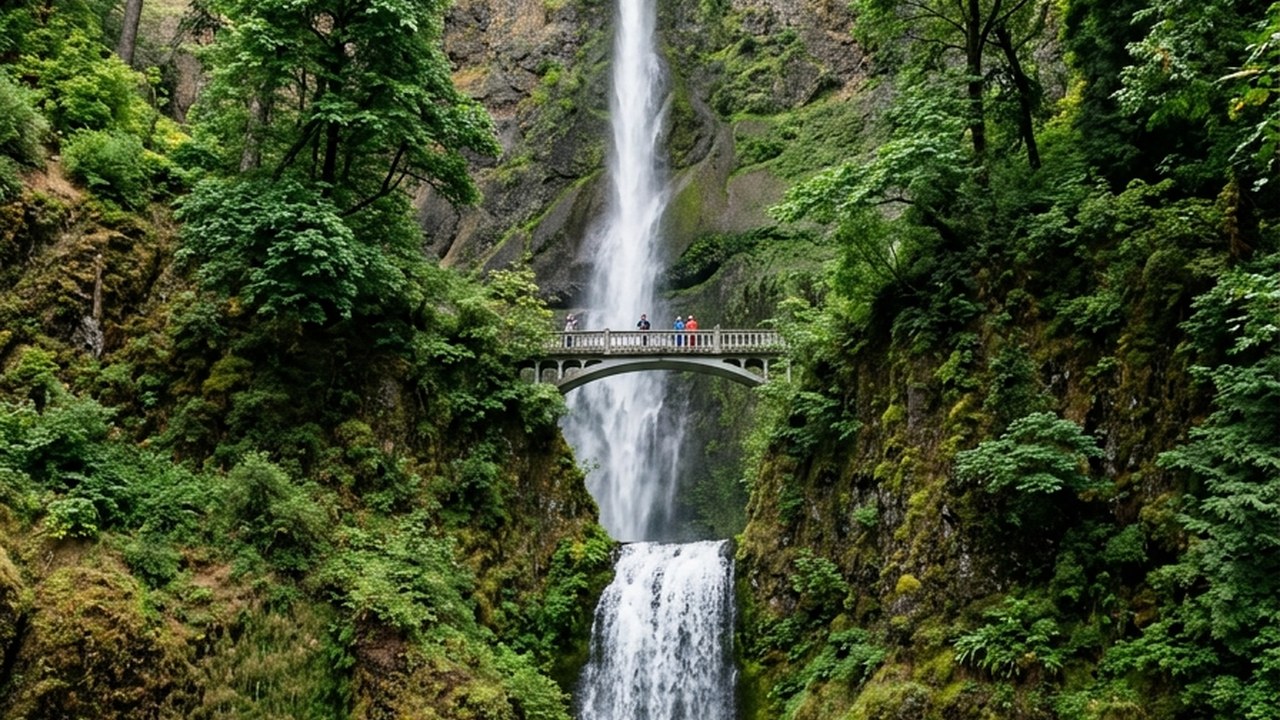
America's first planned scenic highway winds past sheer basalt cliffs, temperate rainforest ferns, and the highest concentration of cascading waterfalls in North America.
Multnomah Falls plummets 620 feet in two tiers, featuring an accessible paved path leading to the iconic Benson Bridge directly above the lower cataract.
Vista House at Crown Point perches 733 feet above the roaring Columbia River, offering expansive 360-degree panoramic canyon views.
9. Olympic Peninsula Loop (US Highway 101)
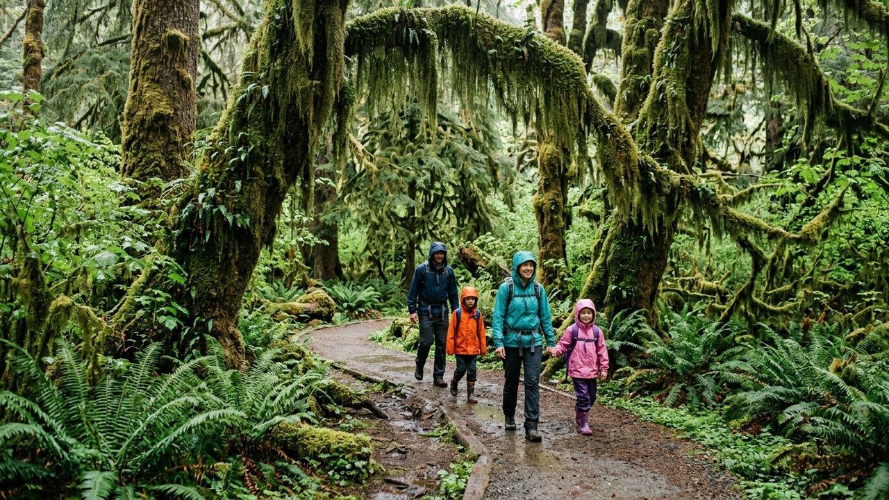
Encircling the glaciated peaks of the Olympic Mountains, this loop connects wild coastal beaches, ancient temperate rainforests, and crystal alpine lakes.
The Hall of Mosses in the Hoh Rain Forest immerses children in a surreal green canopy of towering Sitka spruce draped in curtains of hanging club moss.
Ruby Beach and Rialto Beach feature sea stacks, tidal marine life, and massive weathered driftwood logs washed ashore by the Pacific Ocean.
10. Sedona to Grand Canyon via Oak Creek Canyon
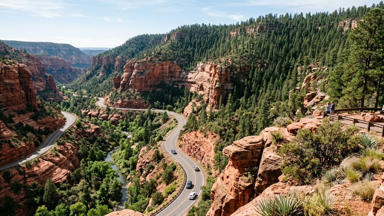
Climbing from red rock sandstone towers through the lush riparian canyon of Oak Creek to high-elevation ponderosa pine forests, this route offers sudden dramatic transitions.
Slide Rock State Park features a natural 80-foot slickrock water chute where children can slide down smooth red sandstone into cool swimming pools.
Arriving at the South Rim of the Grand Canyon reveals the vast mile-deep chasm stretching eighteen miles across to the distant North Rim.
Grand Canyon South Rim Day Tours
Compare guided day trips from Sedona to the Grand Canyon South Rim with round-trip transportation, narrated geology commentary, and park entry.
11. Yellowstone & Grand Teton Mountain Loop
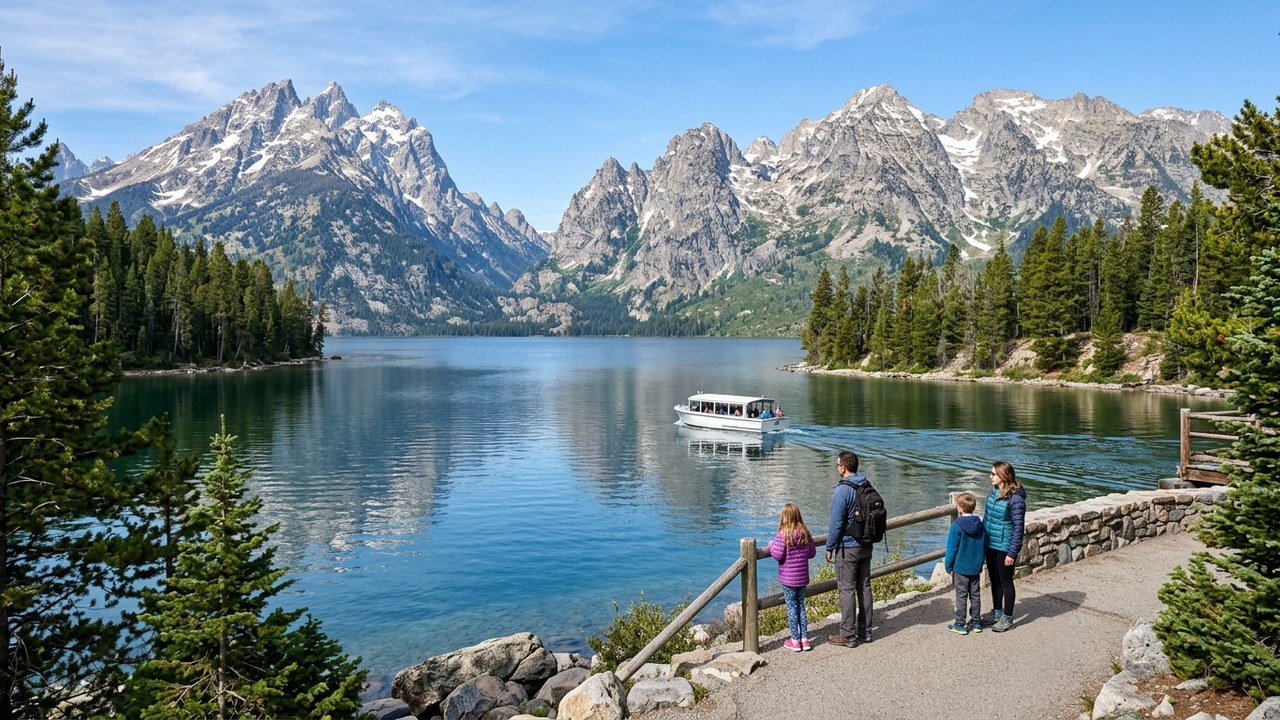
Connecting the jagged spires of the Teton Range with the geothermal supervolcano of Yellowstone, this loop presents an expansive wildlife and geology safari.
Grand Prismatic Spring displays vivid rainbow-hued thermophilic mineral rings over 370 feet wide, while Old Faithful erupts boiling water over 130 feet high.
Jenny Lake in Grand Teton features a scenic boat shuttle that whisks families across turquoise alpine waters to the trailhead for Hidden Falls.
Yellowstone Wildlife Safaris
Compare expert-led wildlife spotting safaris through Lamar and Hayden Valleys using high-powered scopes to safely observe bears, wolves, and bison.
12. Road to Hana (Maui Coastal Highway)
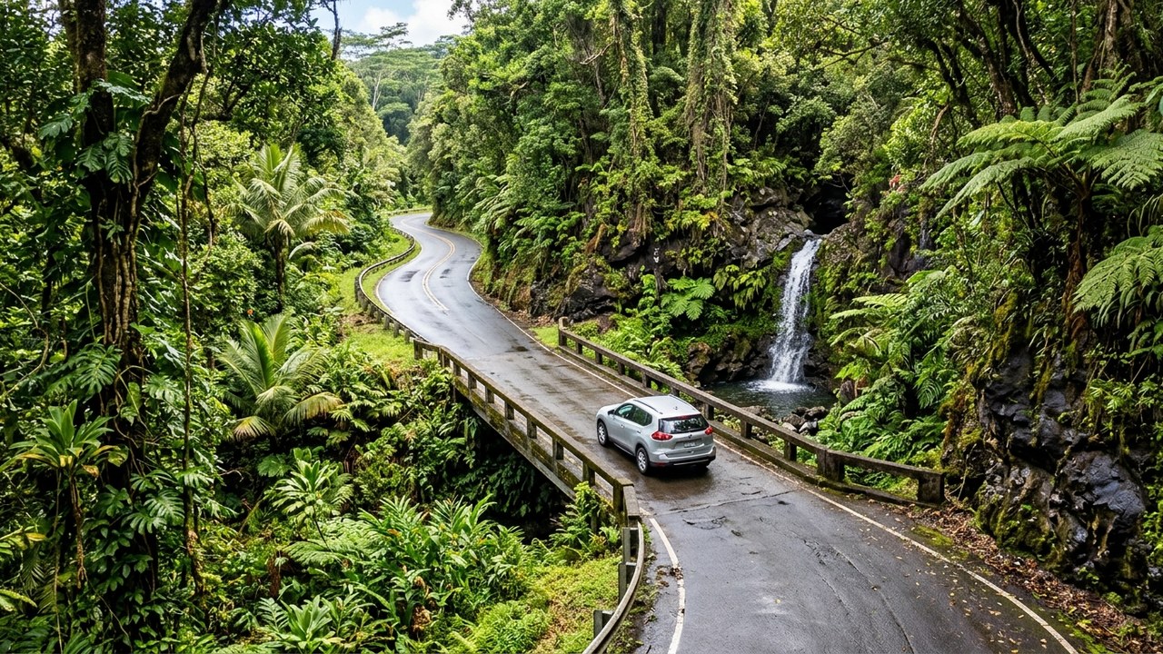
With 620 curves and 59 bridges (46 of which are single-lane), the Road to Hana winds through tropical rainforests, cascading waterfalls, and black sand beaches.
Waianapanapa State Park showcases a pitch-black volcanic sand beach, sea arches, and freshwater caves nestled against emerald coastal vegetation.
Along the roadside, local open-air farm stands offer warm, freshly baked banana bread, fresh mango slices, and chilled coconut water.
Road to Hana Guided Tours
Let a professional local driver navigate 600 switchbacks and single-lane bridges while your family enjoys waterfalls, rainforests, and beaches.
13. Kancamagus Scenic Byway (White Mountains)
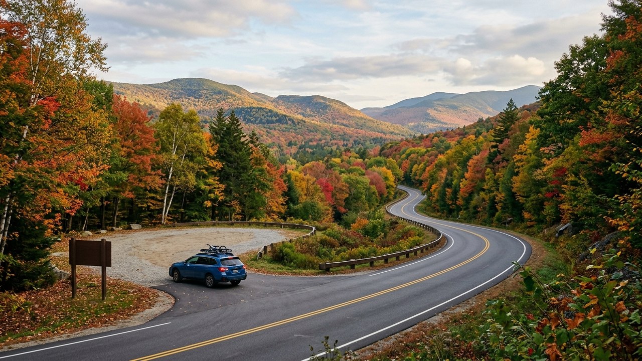
Designated an American Scenic Byway, the Kancamagus Highway cuts through the heart of the White Mountain National Forest without a single commercial storefront.
Sabbaday Falls provides an easy 0.7-mile gravel walking trail suitable for toddlers, leading to a cascading flume waterfall carved into solid granite.
Rocky Gorge and the Swift River feature pedestrian footbridges and smooth granite boulders where families can picnic alongside clear mountain currents.
14. Park Loop Road & Acadia Coastline
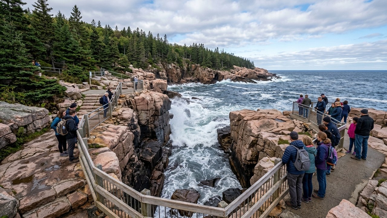
Tracing pink granite coastal cliffs, protected cobblestone beaches, and spruce forests, Acadia's Park Loop Road is a celebrated New England coastal drive.
Thunder Hole booms with water spray when ocean waves crash into a narrow granite inlet, delighting youngsters with sea mist and echoing rumble.
Jordan Pond House invites families to relax on broad green lawns, savoring warm popovers and strawberry jam with views of the twin North and South Bubbles mountains.
15. Badlands to Black Hills Circuit
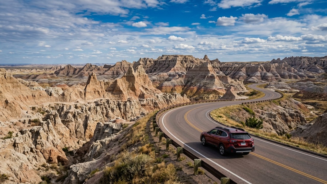
From the surreal, sharply eroded layered buttes of the Badlands to the pine-clad granite spires of the Black Hills, this loop offers extraordinary geological contrast.
The Notch Trail in the Badlands features an exhilarating wooden log ladder and canyon rim walk that older children and teens find deeply memorable.
Along Custer State Park's Wildlife Loop Road, friendly 'begging burros' approach vehicle windows to greet travelers amidst rolling prairie dog towns.
16. Million Dollar Highway (San Juan Skyway)
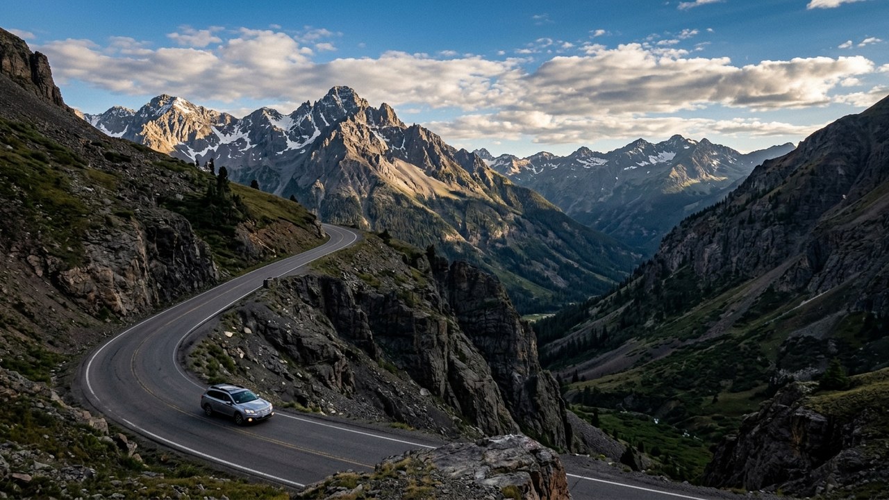
Climbing over three 10,000-foot alpine passes in the San Juan Mountains, this dramatic highway hugs sheer canyon walls with views of historic Victorian mining camps.
In Ouray, nestled inside a dramatic vertical box canyon known as the 'Switzerland of America,' natural hot spring pools welcome families year-round.
Meanwhile, the historic Durango & Silverton Narrow Gauge Railroad allows families to experience high mountain wilderness via authentic steam-powered rail.
Emergency Roadside Assistance Kits
Browse auto emergency kits with jumper cables, tire pressure gauges, and first-aid supplies essential for remote mountain corridors.
17. Lake Superior Circle Tour (North Shore & UP)
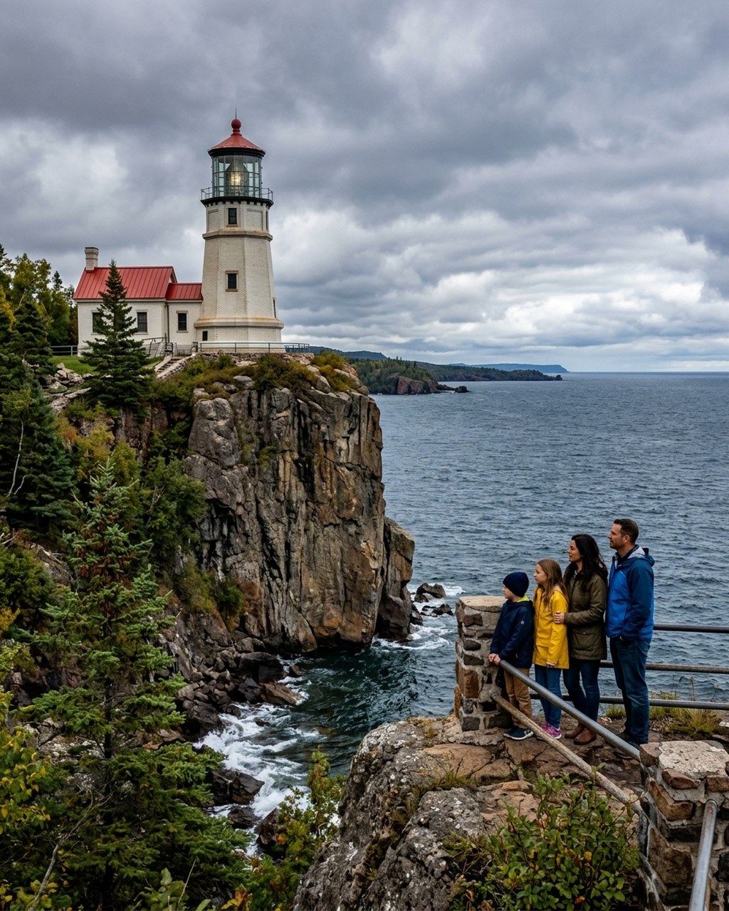
Spanning hundreds of scenic miles, Lake Superior frames a breathtaking circle drive featuring multi-colored sandstone cliffs, lighthouses, and roaring waterfalls.
Pictured Rocks National Lakeshore showcases 200-foot sandstone cliffs banded in vibrant red, green, and gold mineral stains directly above turquoise waters.
Split Rock Lighthouse perches atop a sheer 130-foot basalt cliff above Lake Superior, offering children interactive museum tours of historic maritime life.
18. Shenandoah Skyline Drive
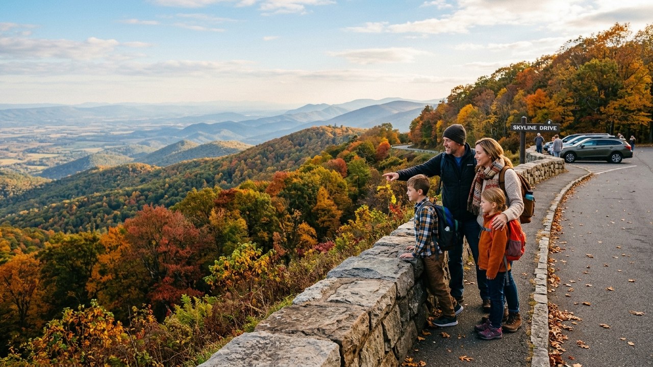
Perched atop the crest of Virginia's Blue Ridge Mountains, Skyline Drive offers 75 scenic overlooks gazing across the pastoral Shenandoah Valley and Piedmont.
Big Meadows at Milepost 51 provides open mountain grasslands where families routinely spot grazing white-tailed deer and wild turkeys at dusk.
Dark Hollow Falls descends 70 feet over rocky green cascades along an accessible 1.4-mile round-trip trail starting directly from the drive.
19. Red Rock Scenic Byway & Grand Staircase
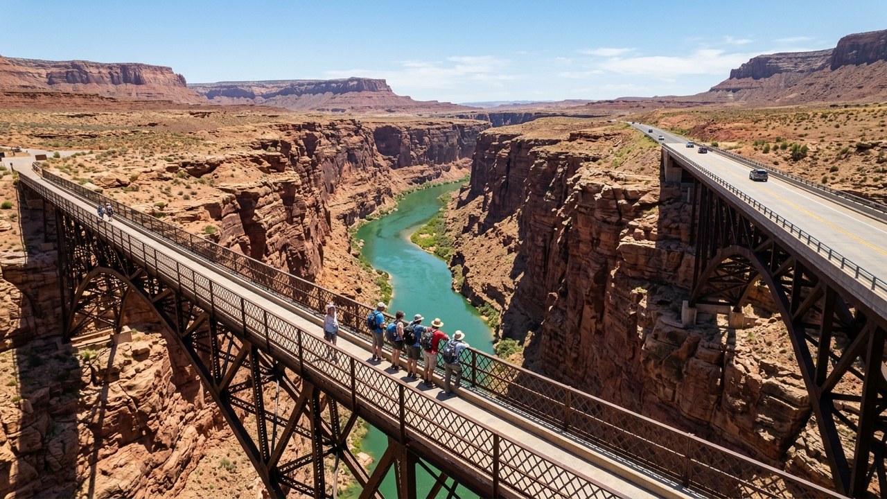
Traversing the dramatic geological transition between the Colorado Plateau and Vermilion Cliffs, this corridor showcases red sandstone monuments and desert rivers.
Navajo Bridge spans 467 feet above the rushing Colorado River at Marble Canyon, where endangered California condors often roost beneath the steel girders.
Coral Pink Sand Dunes State Park features rolling crimson sand dunes where children can rent sandboards and sled down soft slopes.
20. Outer Banks National Scenic Byway (NC-12)
Threading along a fragile ribbon of barrier islands between the Atlantic Ocean and Pamlico Sound, this maritime highway connects dunes, lighthouses, and wild shores.
Jockey's Ridge State Park features expansive natural active sand dunes on the Atlantic coast, making it a wonderful destination for family kite-flying.
Cape Hatteras Lighthouse stands as America's tallest brick beacon, while the free vehicle ferry to Ocracoke Island lets kids feel ocean breezes on the open deck.
21. Tioga Pass & Eastern Sierra Corridor (CA-120)

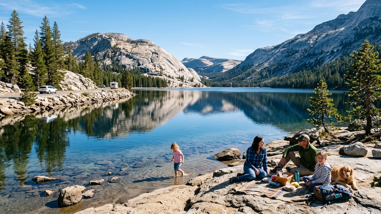
Ascending from Yosemite's valley floor across California's highest highway pass at 9,943 feet, this drive reveals subalpine meadows, glacial granite domes, and saline lakes.
Tenaya Lake offers a pristine sandy beach framed by towering glaciated granite domes, creating an ideal alpine picnic and shallow wading spot for families.
Mono Lake Tufa State Natural Reserve showcases eerie limestone mineral towers rising out of an ancient saline desert lake inhabited by millions of migratory birds.
22. Natchez Trace Parkway
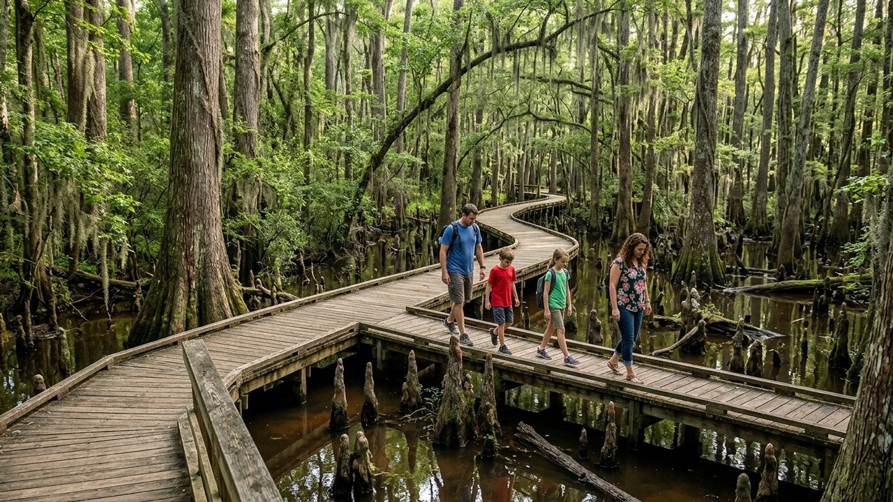
Following an ancient travel corridor used for centuries by Native Americans, European traders, and early settlers, this parkway offers a serene, commercial-free journey.
The iconic Double Arch Bridge near Franklin, Tennessee, spans 1,572 feet across Birdsong Hollow, offering striking architecture against lush rolling hills.
Cypress Swamp at Milepost 122 invites children to stroll elevated wooden boardwalks through water tupelo and bald cypress trees rising from still swamp waters.
MagSafe Wireless Car Mounts
Explore magnetic vent and dashboard phone mounts that keep navigation visible and supply continuous wireless charging on remote scenic drives.
23. Texas Hill Country Willow City & River Loop
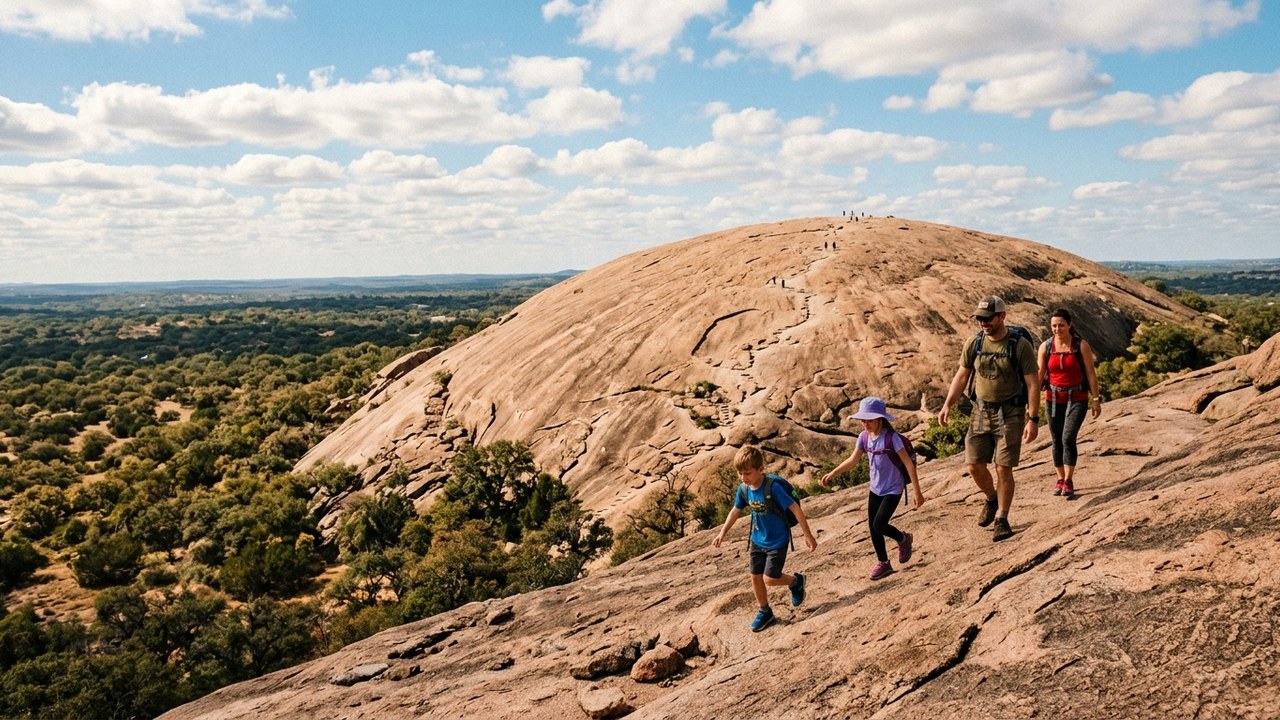
Rolling across spring-fed limestone rivers, historic German pioneer communities, and wildflower pastures, the Texas Hill Country offers quintessential southern charm.
Enchanted Rock State Natural Area features a colossal pink granite batholith dome rising 425 feet, providing an exhilarating slickrock climb with panoramic views.
Historic Fredericksburg welcomes families with vintage ice cream parlors, German bakeries, and pioneer living history exhibits along Main Street.
24. Cascade Loop Scenic Highway (WA-20 & US-2)
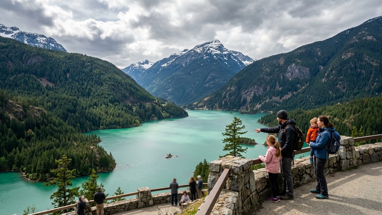
Circling the jagged peaks of North Cascades National Park, the Methow Valley, and Bavarian Leavenworth, this loop is Washington State's ultimate road adventure.
Diablo Lake Overlook reveals brilliant turquoise glacier-fed waters tinted by finely ground glacial rock flour, set against vertical evergreen peaks.
The Western frontier town of Winthrop delights youngsters with wooden boardwalks, vintage soda fountains, and pioneer storefronts.
25. Door County Coastal Byway (WI-42 & 57)
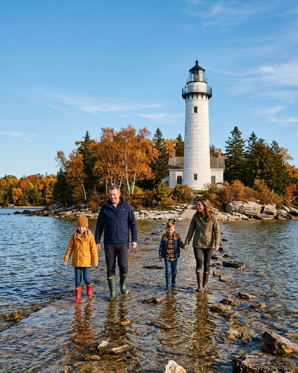
Hugging the limestone bluffs of the Niagara Escarpment and the shores of Lake Michigan, Door County is celebrated for historic lighthouses, cherry orchards, and quiet bays.
Peninsula State Park offers sandy swimming beaches, bicycle rentals along the Sunset Trail, and the historic Eagle Bluff Lighthouse perched above Green Bay.
Cana Island Lighthouse lets children cross a shallow rocky causeway on a tractor-pulled wagon before climbing the 97 spiral steps to the lantern gallery.
26. Trail of the Mountain Spirits (Gila Wilderness)
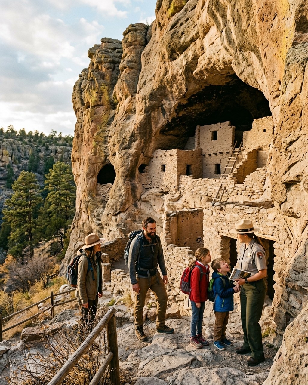
Winding through the rugged volcanic landscapes of the Gila National Forest, this byway leads to ancient Native American cave dwellings in America's first designated wilderness.
Gila Cliff Dwellings National Monument allows children to walk directly inside 700-year-old Mogollon stone rooms built within natural volcanic caves.
Pinos Altos, a historic 1860s gold-mining settlement, features a rustic frontier opera house and historic wooden cabins surrounded by pinon pines.
27. Finger Lakes Scenic Byway (NY-14 & Route 89)
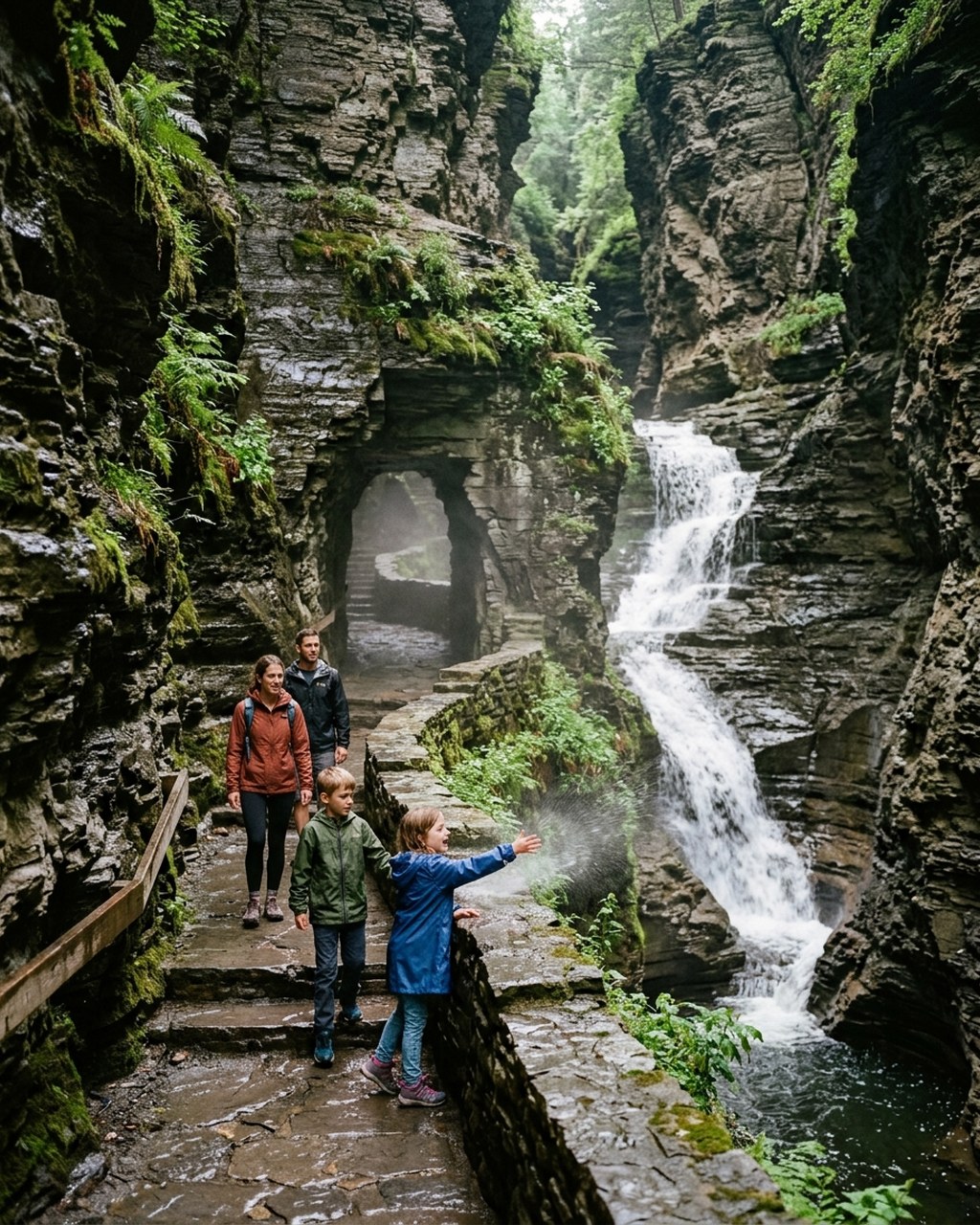
Tracing glacier-carved lakes, rolling vineyard hillsides, and deep slate gorges, the Finger Lakes region of upstate New York is a waterfall wonderland for families.
Watkins Glen State Park Gorge Trail winds through a deep stone canyon past 19 waterfalls, allowing visitors to walk behind the shimmering veil of Cavern Cascade.
Taughannock Falls State Park features a colossal 215-foot plunge waterfall that drops into a forested amphitheater, taller than Niagara Falls.
28. Seward Highway & Kenai Peninsula (AK-1)
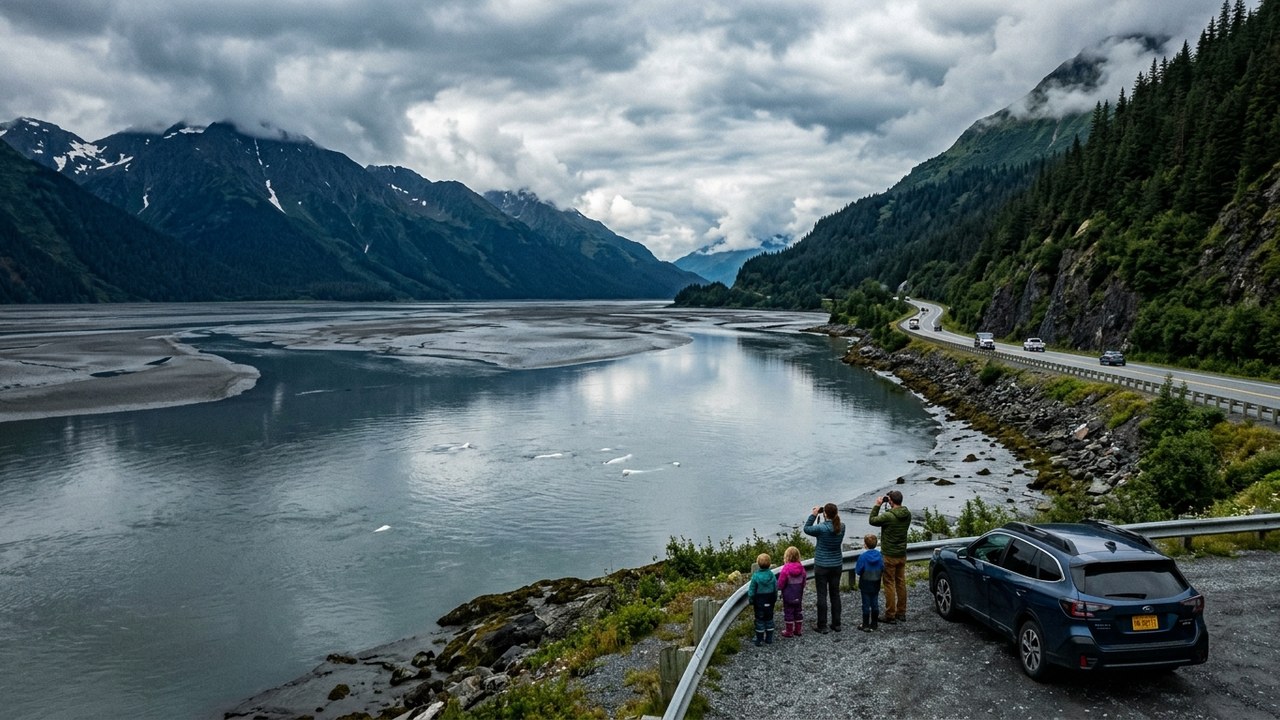
Designated an All-American Road, the Seward Highway skirts the tidal waters of Turnagain Arm before climbing over dramatic glaciated passes of the Kenai Mountains.
Turnagain Arm turnouts offer roadside viewing platforms where families can spot white beluga whales chasing salmon and tidal bore waves rushing up the inlet.
Exit Glacier near Seward allows children to walk along an easy trail to the edge of a massive blue-ice glacier tongue descending from the Harding Icefield.
29. Talimena National Scenic Byway
Cresting the ridge tops of the Winding Stair and Ouachita Mountains, this mountaintop highway offers 22 panoramic vista pull-offs across two states.
Queen Wilhelmina State Park sits atop Rich Mountain (elevation 2,681 feet), featuring a historic lodge, miniature scenic passenger train, and friendly pet pens.
The Rich Mountain Fire Tower invites adventurous families to climb elevated stairs for commanding 360-degree vistas stretching across mountain valleys.
30. Enchanted Circle Scenic Byway
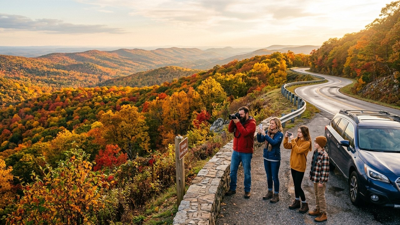
Encircling Wheeler Peak (elevation 13,161 feet), New Mexico's highest summit, this high-mountain loop weaves through historic alpine mining towns and Pueblo heritage sites.
The Rio Grande Gorge Bridge carries visitors 650 feet above the rushing Rio Grande river, with pedestrian walkways providing dizzying canyon perspectives.
Taos Pueblo, a UNESCO World Heritage site, features multi-story adobe dwellings that have been continuously inhabited by Native American families for over 1,000 years.
Frequently Asked Questions
What is the ideal daily driving distance for road trips with young children?
Experienced road-tripping families recommend capping daily driving at 150 to 200 miles (approximately 3 to 4 hours behind the wheel). Breaking the journey into 90-minute driving intervals separated by playgrounds, short nature walks, or roadside attractions prevents child fatigue and maintains trip excitement.
How should families handle national park vehicle reservations along major road corridors?
Seasonal vehicle reservation guidelines and entrance requirements should be confirmed directly on official park portals for current travel seasons. Specific high-demand scenic corridors—such as Glacier's Going-to-the-Sun Road west side and Acadia's Cadillac Mountain sunrise summit—frequently require advance vehicle bookings via Recreation.gov during peak summer months.
What essential vehicle and emergency gear should be packed for cross-country routes?
Always carry a portable 12-volt tire inflator, jumper cables or a lithium battery booster pack, an extensive first-aid kit, a minimum of one gallon of drinking water per person, non-perishable snacks, paper road atlases, and pre-downloaded offline navigation maps on mobile devices.
How can families maintain reliable navigation when driving through remote cellular dead zones?
Download offline area maps on Google Maps or Apple Maps before departing major metro hubs. In addition, carrying a laminated national road atlas ensures reliable route navigation across remote mountain passes, desert corridors, and national forests where cellular data signals disappear completely.
What strategies help children stay entertained without relying exclusively on digital screens?
Incorporate classic travel games such as the license plate spotting game, roadside scavenger bingo, audible family audiobooks, and national park junior ranger activity booklets. Rewarding kids with small souvenirs or regional treats at milestone waypoints helps keep children engaged in the surrounding landscapes.
Conclusion: Crafting Lifelong Memories Across America's Highways
America's expansive highway network connects a continent of vast natural diversity, from soaring coastal cliffs and geothermal wonderlands to mist-shrouded mountain crests and timeless historic towns. Taking the family onto these storied corridors provides children with an active education in geography, geology, and American cultural heritage that no textbook or screen can replicate.
The secret to a triumphant family road trip lies not in racing toward the final destination, but in embracing the rhythm of the open road. By keeping daily driving distances manageable, celebrating unexpected roadside discoveries, staying safe on remote wilderness trails, and respecting delicate natural ecosystems, your family will create shared stories and bonds that endure for generations.
Plan Your America Trip: Stays, Guided Experiences & Gear
Tap your travel style below for a personalized match, or lock in refundable accommodation rates and skip-the-line attraction tickets (powered by Viator, a Tripadvisor company) before peak dates sell out:


Comments